The Chess Valley Walk
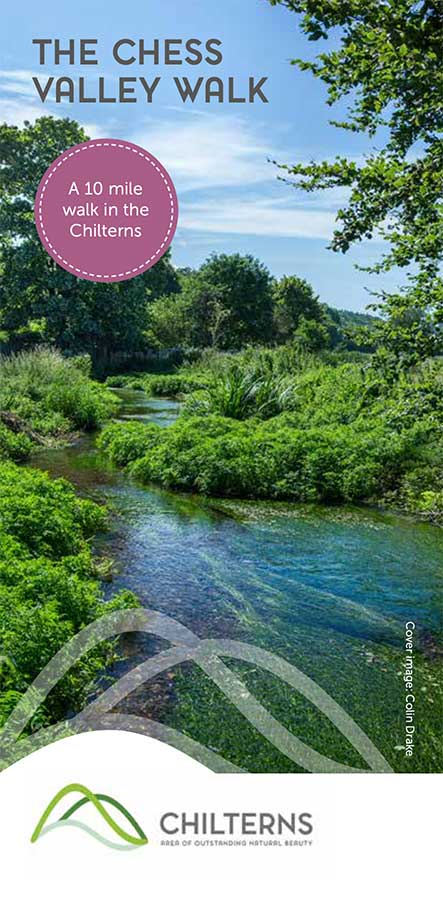
Starting at Rickmansworth, Chorleywood or Chalfont & Latimer tube stations, three linear walks to Chesham. With historic buildings and estates, water meadows, ancient field systems and nature reserves.
Starting at Rickmansworth, Chorleywood or Chalfont & Latimer tube stations, three linear walks to Chesham. With historic buildings and estates, water meadows, ancient field systems and nature reserves.
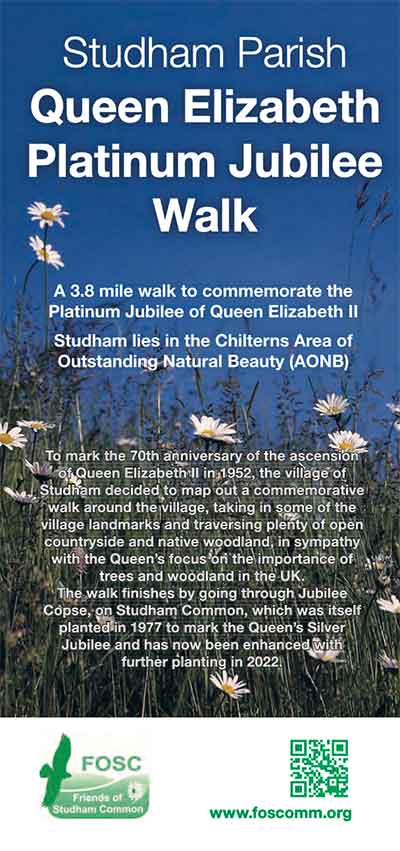
To mark the 70th anniversary of the ascension of Queen Elizabeth II in 1952, this commemorative walk around the village, takes in some of the village landmarks and plenty of open countryside and native woodland.
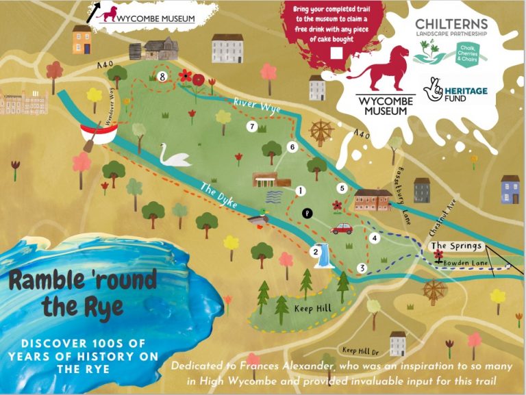
Discover hundreds of years of history on the Rye in High Wycombe – a children’s treasure hunt.
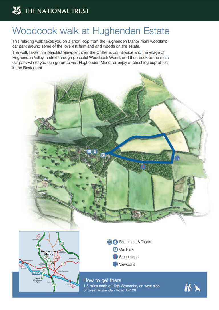
Short circular walk: 1 mile (1.6km), farmland and woods on the Hughenden Estate, allow 45 minutes. Start and finish: Info Point, main woodland car park at Hughenden Manor.
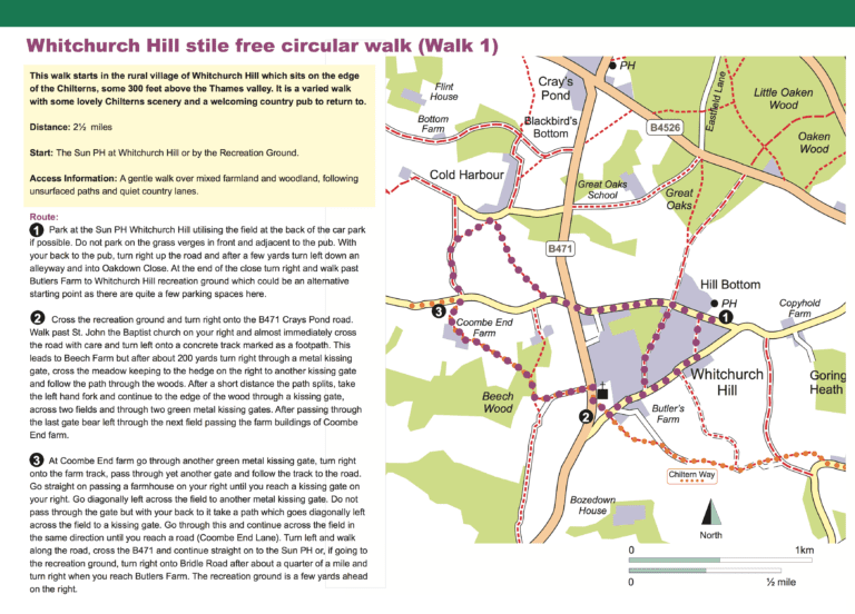
Short circular walk: 2½ miles (4km), mixed farmland and woodland, allow 1¼ hours. Start and finish: The Sun PH at Whitchurch Hill or by the Recreation Ground.
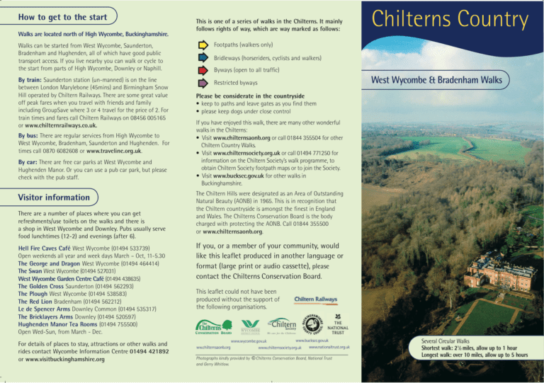
Several circular walks. Shortest walk: 4 km (2½miles), allow 1 hour. Longest walk: over 16 km (10 miles), allow 5 hours.
Six heritage trails tracing the women’s suffrage movement in and around the Chilterns. The walks range from 2.4 to 12½ miles and the leaflet describes: each walk, the location of memorials and other places of relevance along the way. 4…
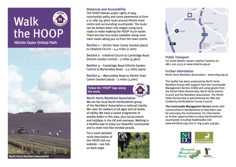
The Hitchin Outer Orbital Path follows public rights of way, countryside paths and some pavements to form a 12 mile (19.3km) route around Hitchin. The route can be broken down into stages and there are bus services to/from the town…
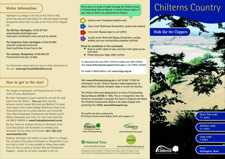
Long walk: 11 km (7 miles), allow 3 hours. Short walk: 9 km (5½ miles), allow 2½ hour. Pub walk: 2½ km (1½ miles), allow 1 hour. Start and finish: Harlington, Beds.
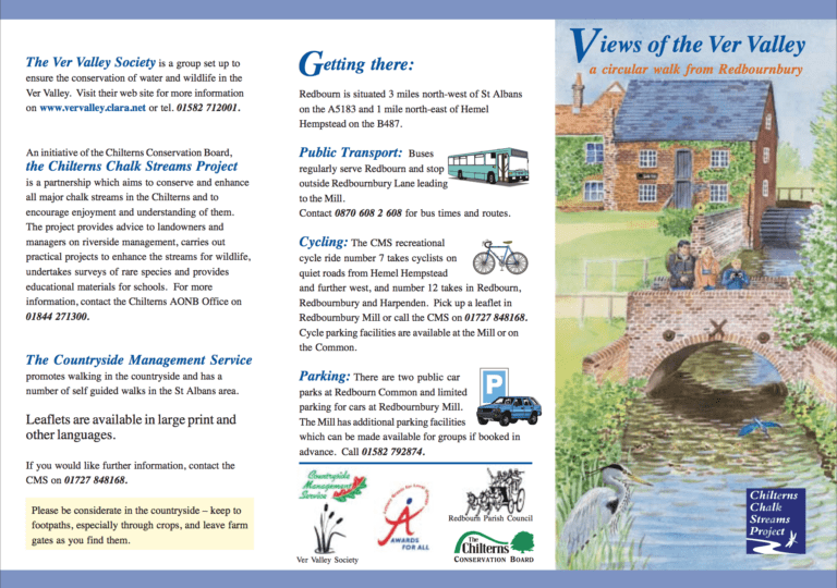
Long route: 4 miles (6.5km), allow 2½ hours. Short route: 3 miles (5km), allow 2 hours, cirular walk with hills, stiles and steps. Start and finish: Redbourn Common or Redbournbury Mill.
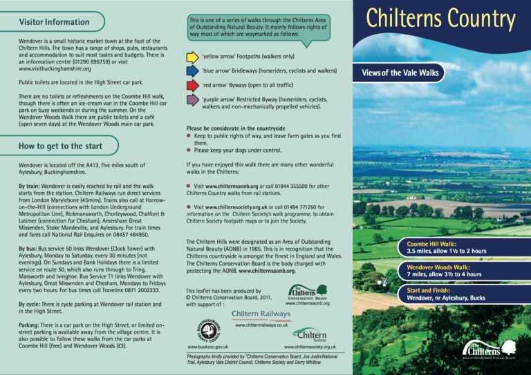
Coombe Hill Walk: 3½ miles, allow 1½ to 2 hours. Wendover Woods Walk: 7 miles, allow 3½ to 4 hours. Start and finish: Wendover, nr Aylesbury, Bucks.
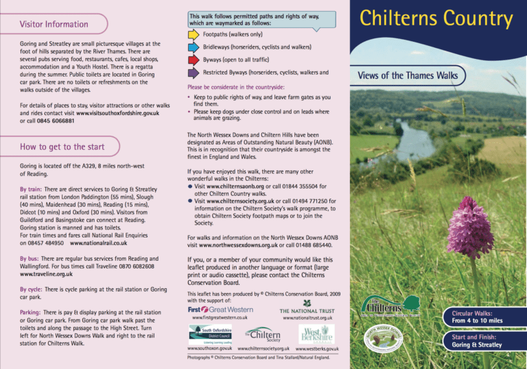
Circular walks from 6½ to 16 km (4 to 10 miles), 2 to 5 hours. Start and finish: Goring or Streatley.
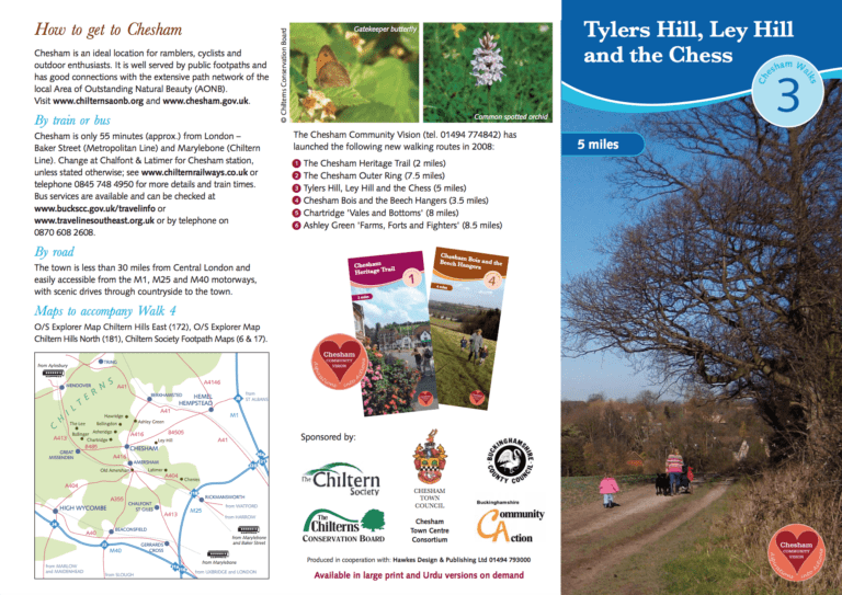
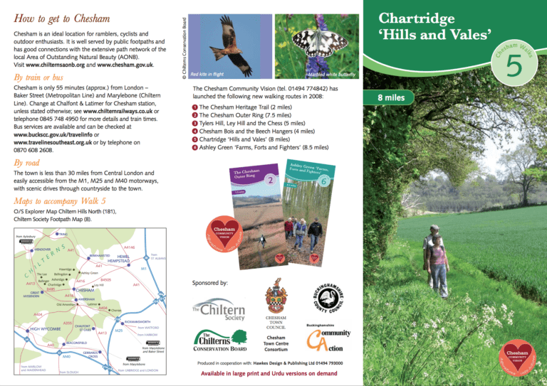
This 8 km (5 mile) walk to the east of Chesham, explores the network of paths in beautiful rolling countryside lying between Chesham and the cluster of villages of Tylers Hill, Ley Hill and Botley.
A 1½ km (1 mile) linear path.
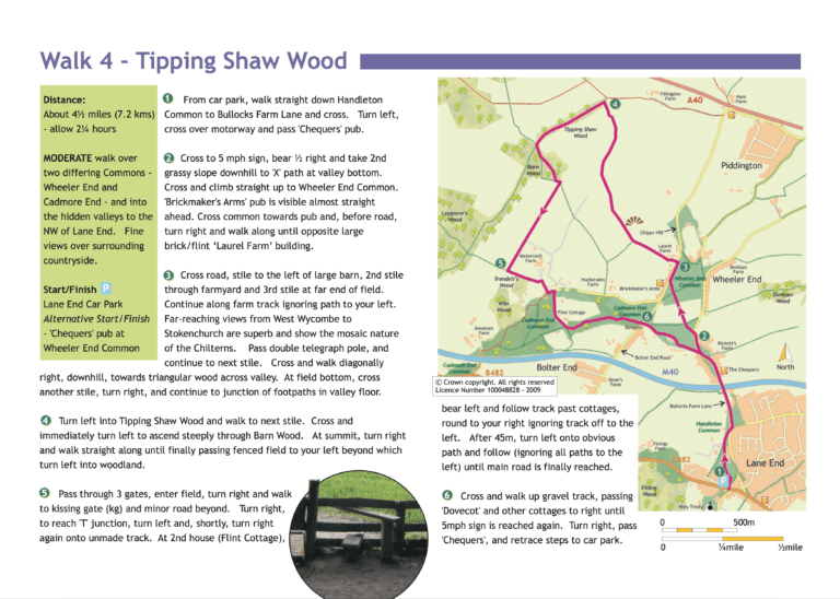
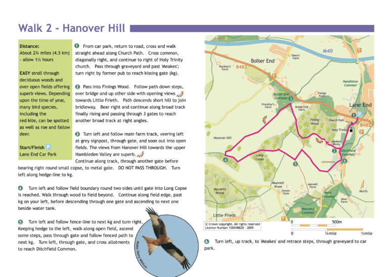
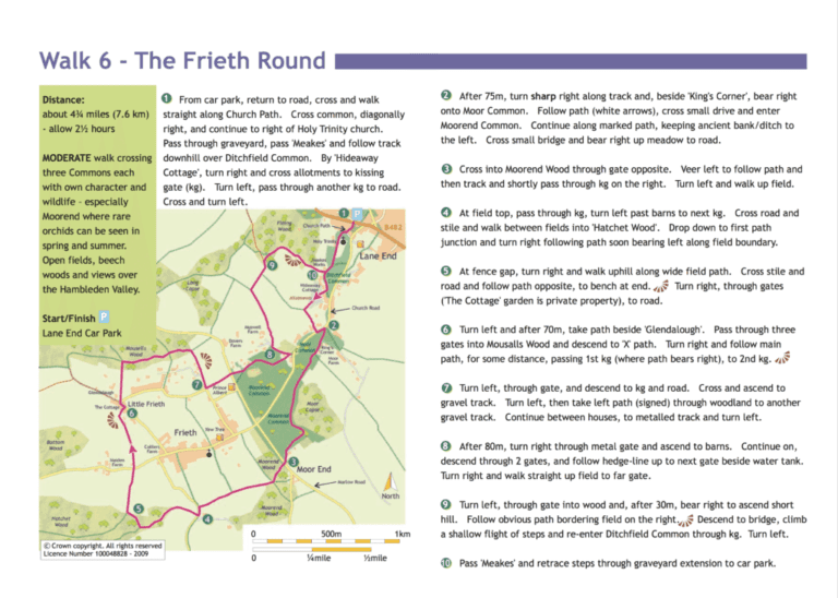
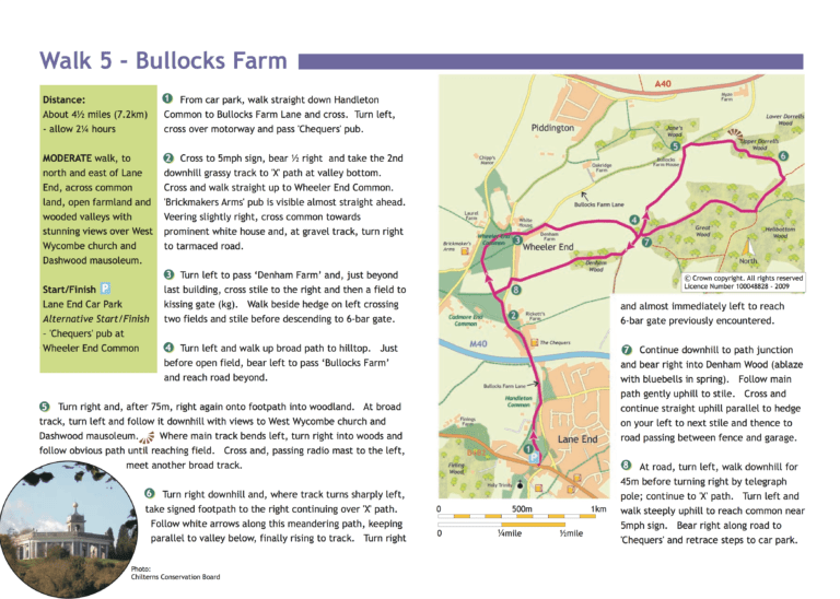
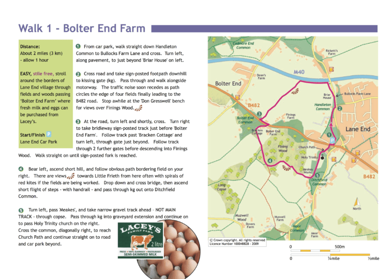
Moderate circular walk: 4½ miles (7.2km), commons and hidden valleys, allow 2¼ hours. Start and finish: Lane End car park.
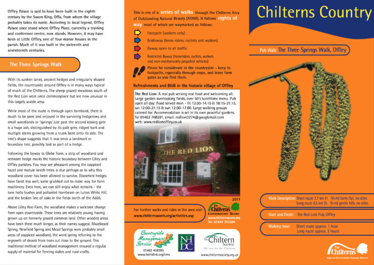
Long walk: 8½ km (5¼ miles) gentle hills, no stiles. Allow 2½ hours. Short walk: 2¾ km (1¾ miles) fairly flat, no stiles. Allow 1 hour. Start and finish: The Red Lion, Offley.
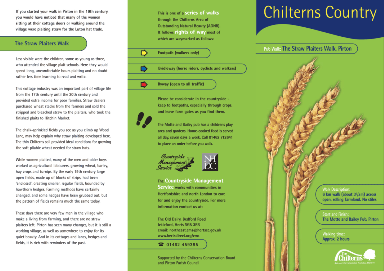
3½ mile (6 km) walk across open, rolling farmland; no stiles. Allow 2 hours. Start and finish: The Motte and Bailey, Pirton.
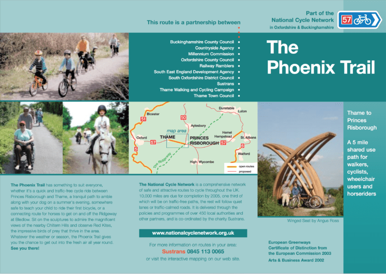
Moderate walk: 5 miles, linear shared path for walkers, cyclists and wheelchair users. Start: Thame centre. Finish: Princes Risborough centre.
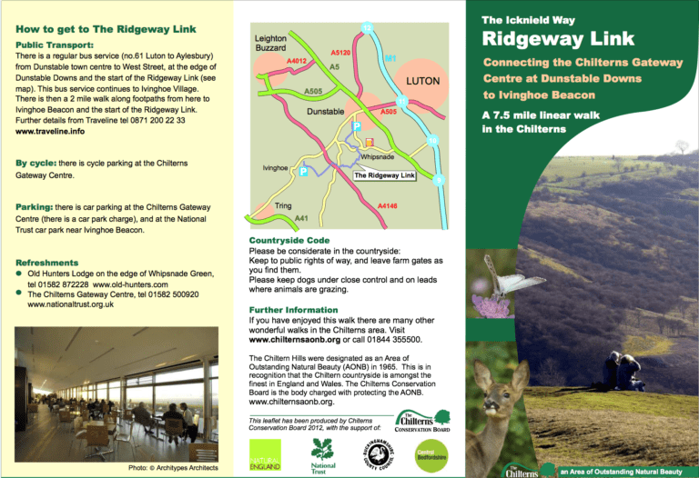
7½ miles (12 km), linear walk through rolling chalk hills and woodlands, allow 4½ hours. Start: Chilterns Gateway Centre at Dunstable Downs. Finish: Ivinghoe Beacon.
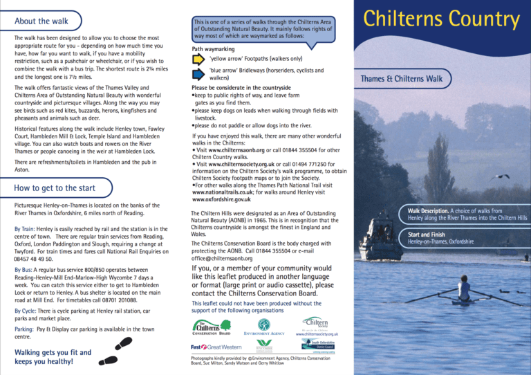
A choice of walks of 2½ and 2¾ miles, from Henley along the River Thames into the Chiltern Hills. Start and finish: Henley-on-Thames, Oxfordshire.
Short circular walk: 1½ miles (2.4 km), open grassed area, allow 45 minutes. Start and finish: War Memorial, West Common.
Circular Walk: 6.5 miles (11km) Allow 3.5 hours. Station to Station Walk: 5½ miles (9 km). Allow 3 hours. Start and finish: Seer Green & Jordans station / Beaconsfield station.
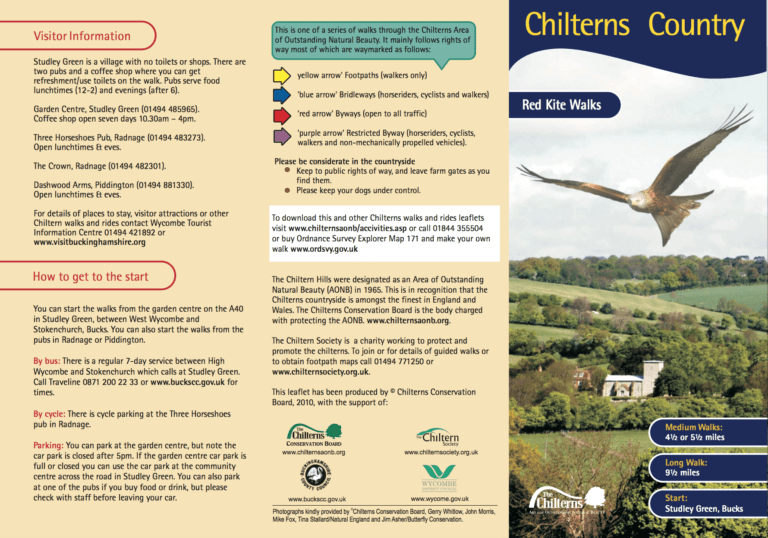
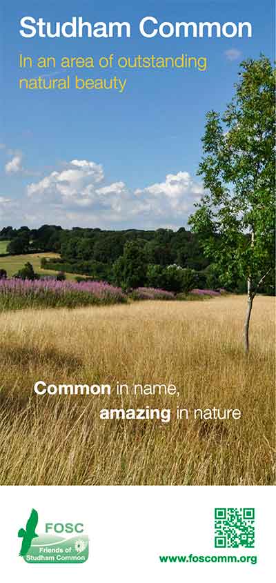
Long walk: 15 km (9½ miles). Allow 4 hours. Medium walks: 7 and 9 km (4½ and 5½ miles). Allow 2 and 3 hours. Start and finish: Studley Green, Bucks.
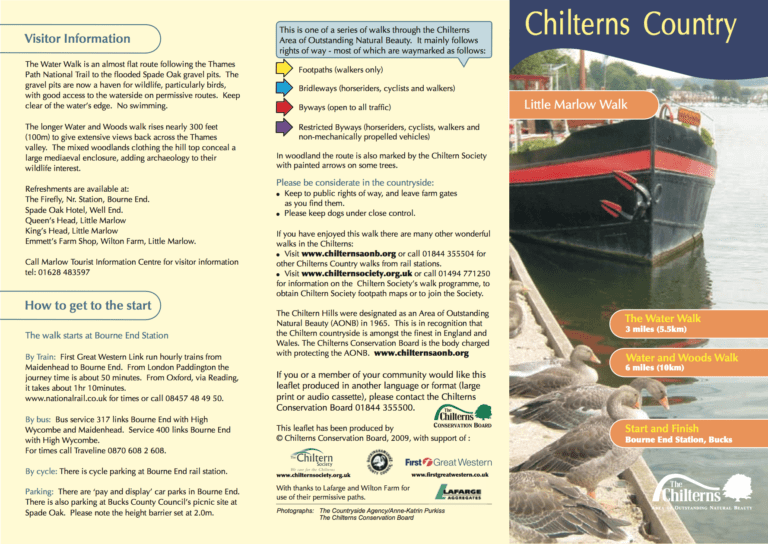
Water and Woods Walk: 6 miles (10 km), allow 3 hours. The Water Walk: 3 miles (5½ km), allow 1½ hours. Start and finish: Bourne End station, Bucks.
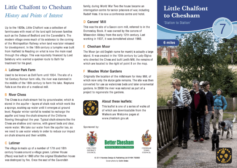
This 9.7 km (6 mile) walk starts at Chalfont & Latimer station and finishes at Chesham, both on the Metropolitan Line. Several interesting waypoints are all described in the leaflet, including the sites of: a 1st century Roman villa, a…
Short walk: 3 miles (5.5km), circular walk through open country and woods with some strenuous climbs, allow 1.75 hours. Start and finish: Step’s Hill Car Park off the road from Ringshall to Ivinghoe Beacon.
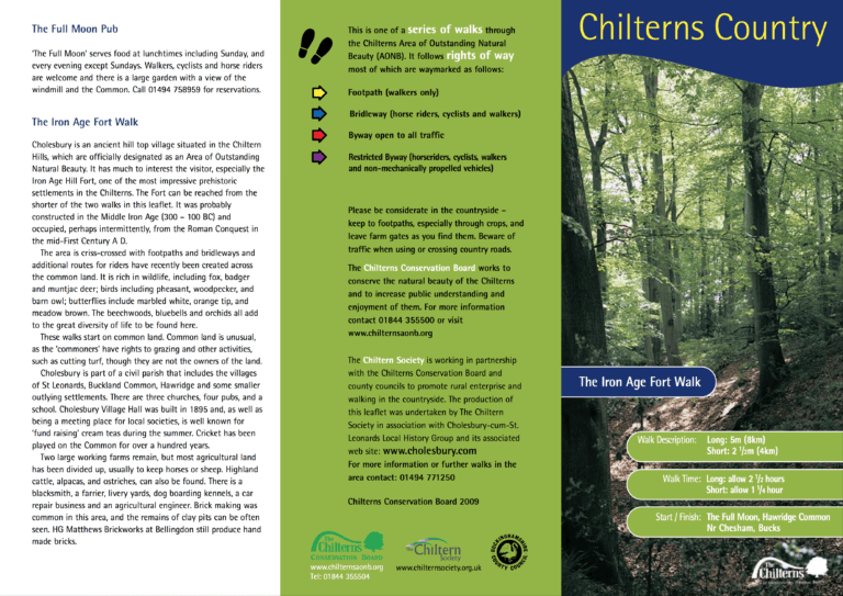
Long walk: 8 km (5 miles), allow 2½ hours. Short walk: 4 km (2½ miles), allow 1¼ hours. Start and finish: The Full Moon, Hawridge Common, nr Chesham, Bucks.
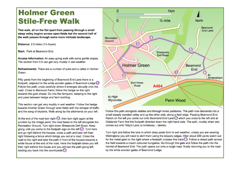
Short walk: 2½ miles (4km), easy walk through fields with gentle slopes, allow 1¼ hours. Start and finish: Beamond End.
Short walk: 2¾ miles (4.5km), easy stroll through woods and open fields, allow 1½ hours. Start and finish: Lane End Car Park.
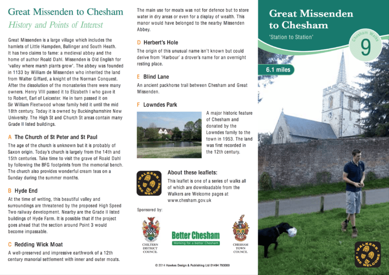
This 9.8 km (just over 6 mile) walk starts at Great Missenden railway station and finishes at Chesham Metropolitan line station. Several interesting waypoints are all described in the leaflet, including: the site of a Saxon church, 12th century earthworks…
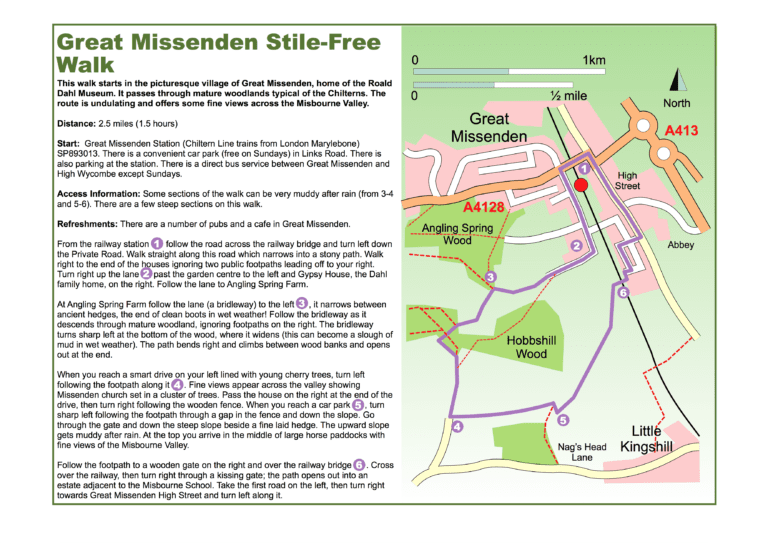
Short walk: 2½ miles (4km), undulating walk through woodland, no stiles, allow 1½ hours. Start and finish: Great Missenden Station.
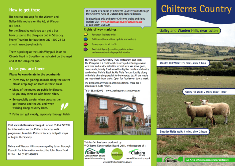
Streatley Fields Walk: 4 miles (6½ km), allow 2 hours. Galley Hill Walk: 2 miles (3¼ km), allow 1 hour. Warden Hill Walk: 1¾ miles (2¾ km), allow 1 hour. Start and finish: Warden Hill Road or Chequers pub.
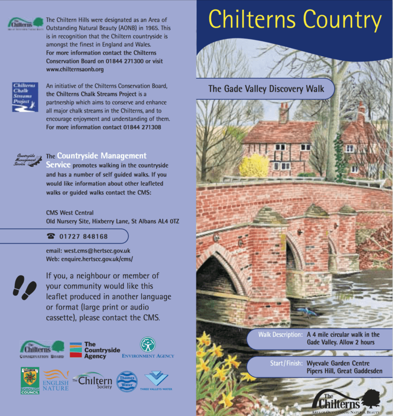
Moderate walk: 4 miles (7km), water meadows and villages in the Gade Valley, allow 2 hours. Start and finish: Wyevale Garden Centre, Pipers Hill, Great Gaddesden.
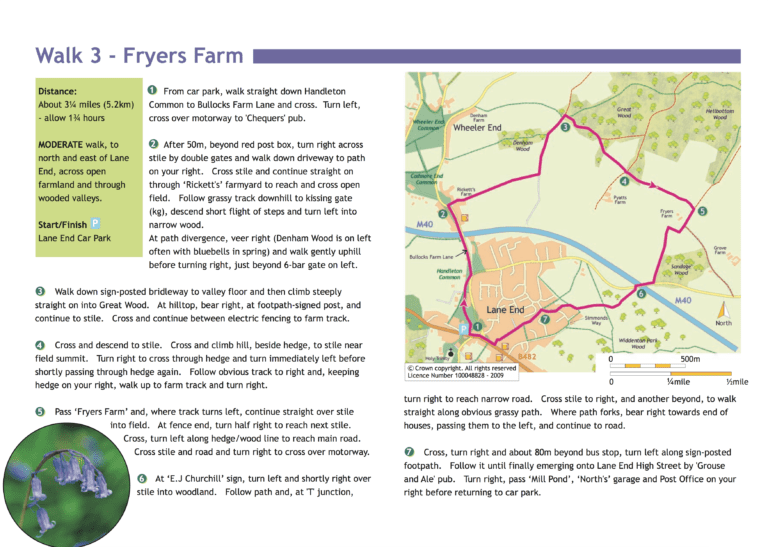
Short walk: 3¼ miles (5.2km), moderately easy farmland and wooded valleys, allow 1.75 hours. Start and finish: Lane End Car Park.
Moderate circular walk: 4¾ miles (7.6km), commons and beech woods, allow 2½ hours. Start and finish: Lane End car park.
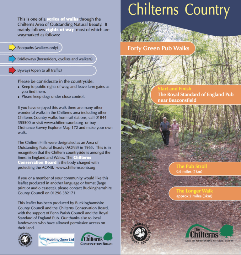
Pub Stroll: Just over ½ mile (1km), allow 30 minutes. Longer walk: 2 miles (3.5km), allow 1 hour, woodland, meadows and hills. Start and finish: Royal Standard of England PH, Forty Green.
Short walk: 2½ miles (4km), undulating farmland, allow 1¼ hours. Moderate walk: 6 miles (10km), undulating farmland, allow 3 hours. Start and finish: Car Park at the junction of Friendless Lane & Mill Lane.
Short walks: 1.5miles-3½ miles (3km-6km) gentle circular walks on quiet lanes, no stiles, 1 hill, allow 45 minutes to 2 hours. Start and finish: Wellplace Zoo, Wallingford.
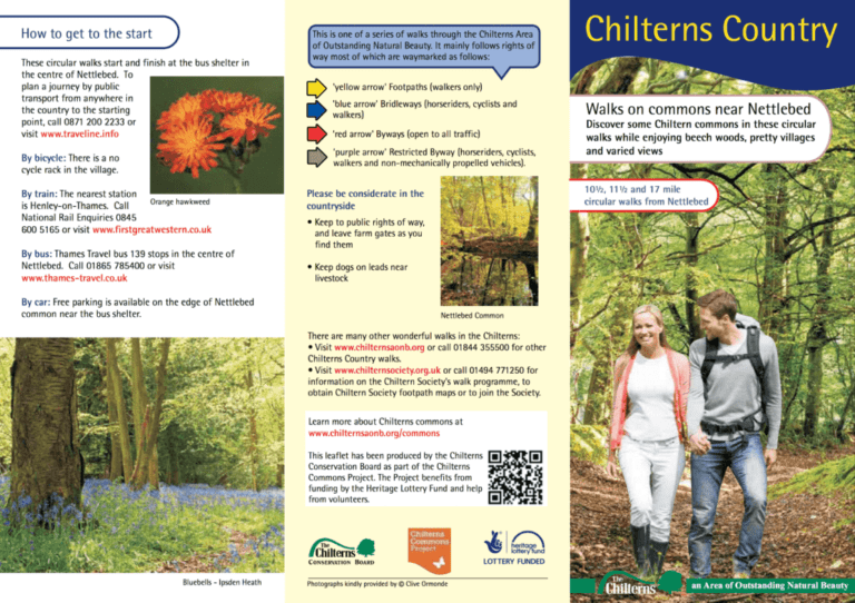
17 mile: start/finish at Nettlebed. 10½ mile: start/finish at Nettlebed. 11½ mile: start/finish at Nettlebed. Includes Lower Common Wood, Greys Green, Peppard common, Kingwood common, Ipsden Heath, Nuffield common and Nettlebed common.
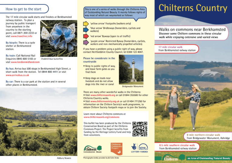
17 mile: start/finish at Berkhamsted railway station. 8 mile: start/finish at Bridgewater Monument, Ashridge. 8½ mile: start/finish at Berkhamsted railway station. Includes Berkhamsted, Pitstone, Ivinghoe, Aldbury and Northchurch commons.
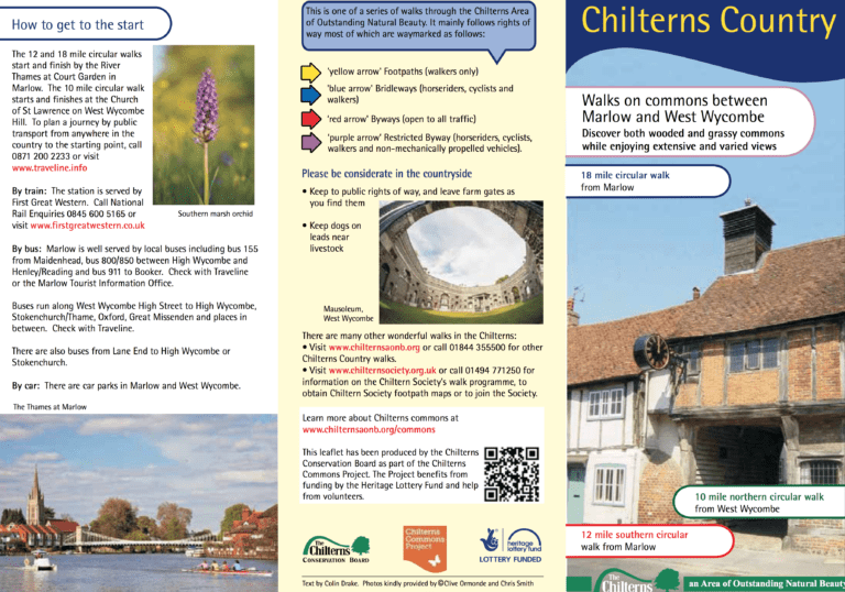
18 mile: start/finish at Marlow. 10 mile: start/finish at West Wycombe. 12 mile: start/finish at Marlow. Includes Marlow, Moorend, Ditchfield, Handleton and Wheeler End commons, West Wycombe Hill (which is a common), Toweridge and Booker commons.
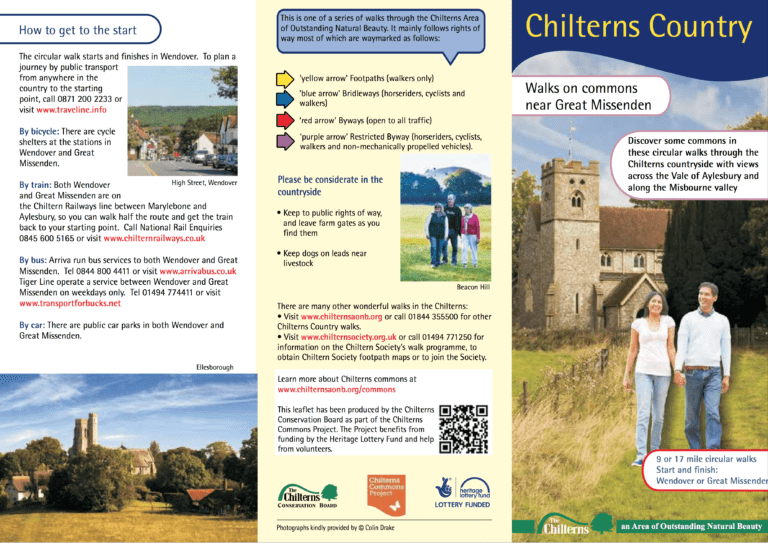
17 mile: start/finish at either Wendover or Great Missenden. 9 mile: start/finish at Wendover. 9½ mile: start/finish at Great Missenden. Includes Little Hampden common and Great Hampden common.
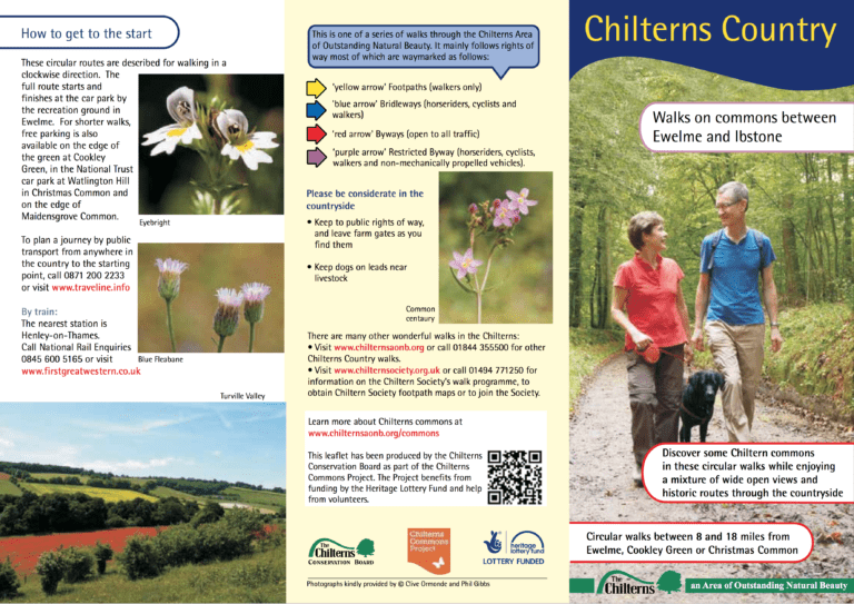
18 mile: start/finish at Ewelme. 8 mile: start/finish at Christmas Common. 8½ mile: start/finish at Ewelme. 9¾ mile: start/finish at Cookley Green. Includes Watlington Chalk Pits, Ibstone common, Turville Heath, Maidensgrove common, Cookley Green and Ewelme’s cow common.
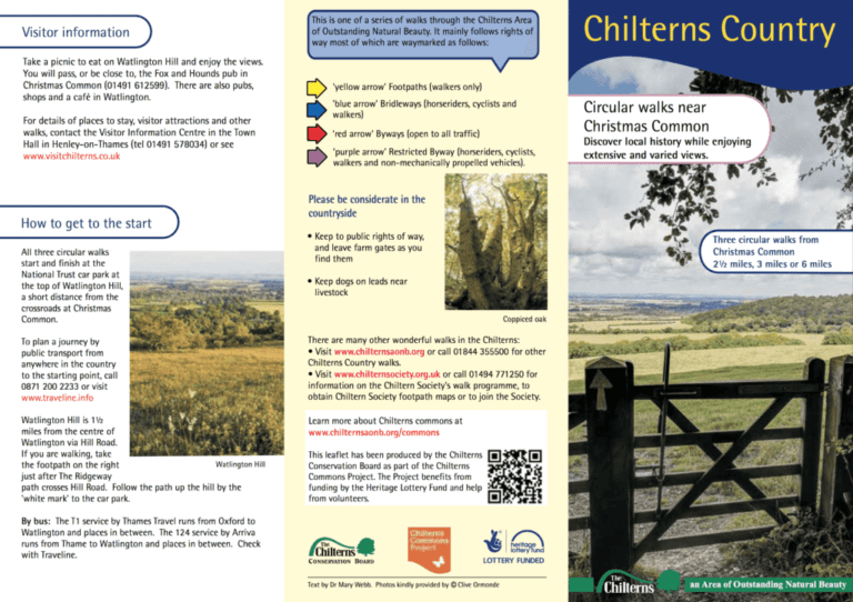
2½ miles, 3 miles or 6 miles each starting and finishing at Christmas Common. There is no longer any common land at Christmas Common. On these walks you will discover local history and see features of landscape archaeology indicating where…
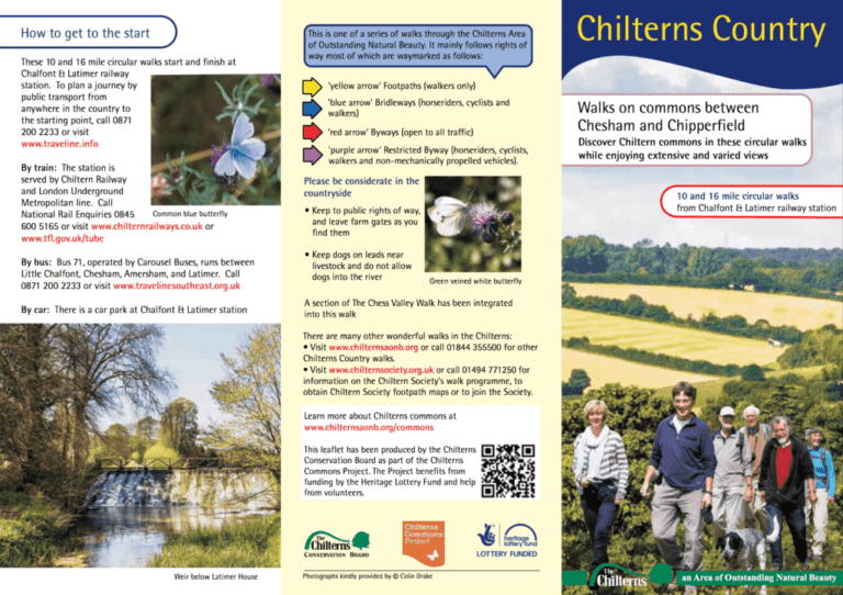
Includes Chesham Moor, Big Round Green, Ley Hill common, Chipperfield common and Dawes common.
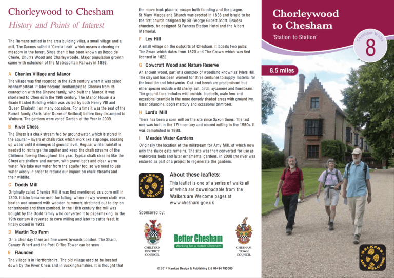
This 13.7 km (8½ mile) walk starts at Chorleywood station and finishes at Chesham, both on the Metropolitan Line. Several interesting waypoints are all described in the leaflet, including: Chenies Manor, views of the London skyline (on a clear day)…
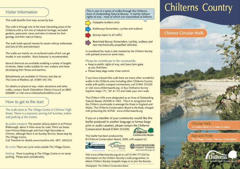
Short walk: 2 miles (3.5km) hills, woodland, stiles, allow 1 hour. Longer walk: 5½ miles (9km) hills, woodland, several stiles, allow 2½ hours. Start and finish: Chinnor Village Centre.
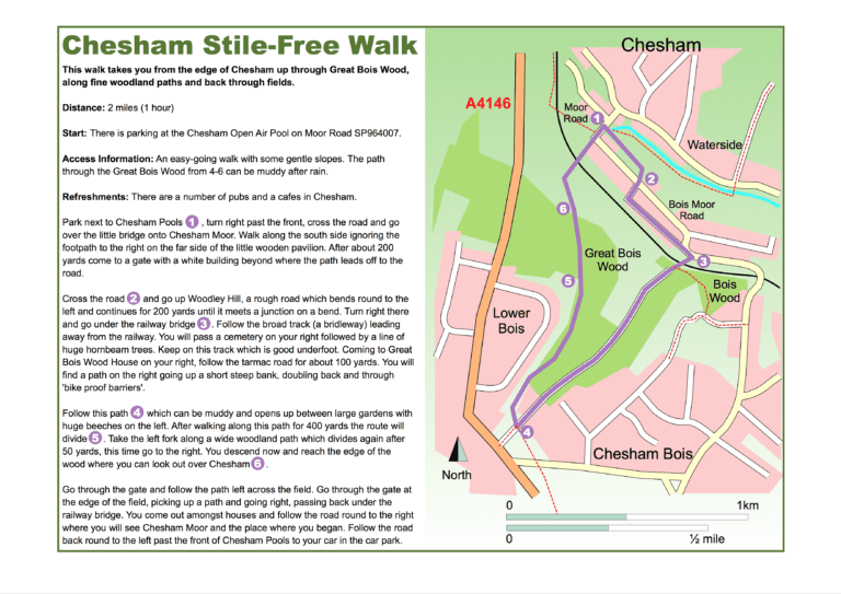
Short walk: 2 miles (3.5km), easy walk with gentle slopes, woodland and fields, allow 1 hour. Start and finish: Chesham Open Air Pool.
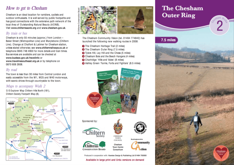
This walk skirts the outer fringes of Chesham. The total length is 13 km (7½ miles).
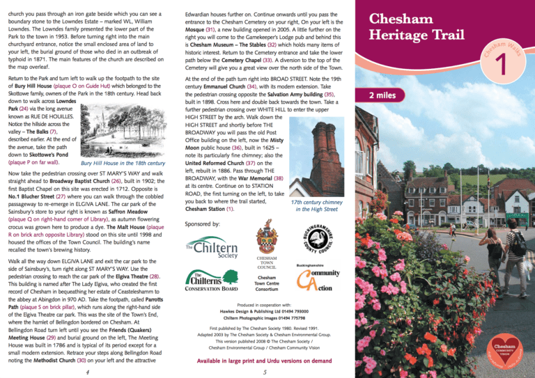
A 3 km (2 miles) circular walk taking in 1,000 years in the history of Chesham.
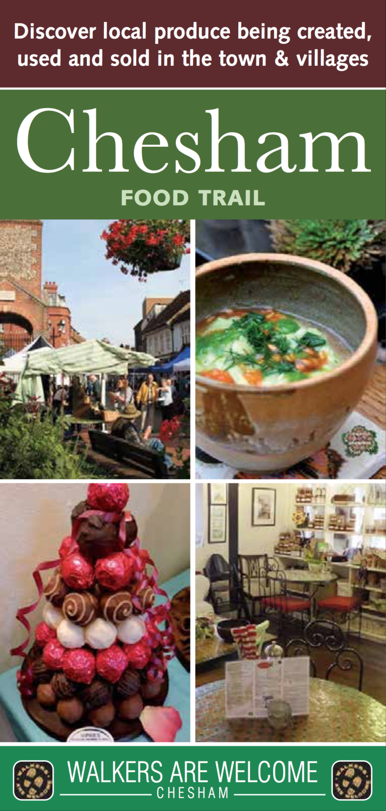
This leaflet contains four trails; one in the town and three in the surrounding countryside. Chocolate, bread, the Chesham Sausage, local honey and many other surprises are to be found in town. In the countryside the visitor will find apple…
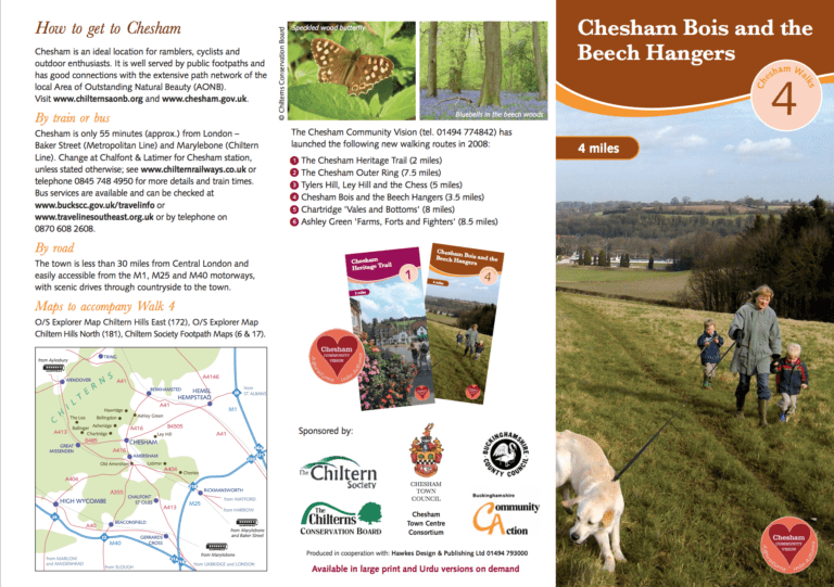
The Chilterns are well known for their beech woodlands. This 6½ km (4 mile) gentle walk takes you through the beech hangers on Chesham’s doorstep enabling you to appreciate their beauty.
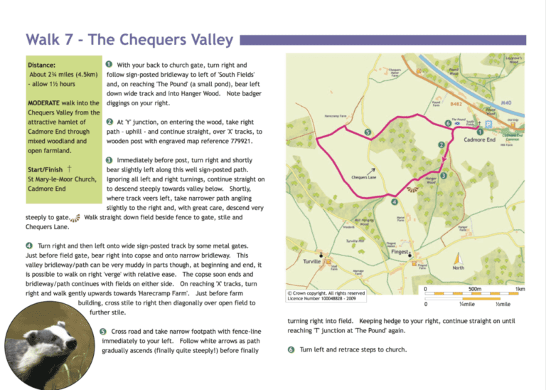
Short circular walk: 2¾ miles (4.5km), mixed woodland and open farmland. Start and finish: St Mary-le-Moor Church, Cadmore End.
3½ km (2¼ miles), allow 1 hour. Various start and finish points.
A 13 km (8 miles) walk in the valleys to the west of Chesham along which run tracks with curious names such as Herbert’s Hole and Blind Lane, and roads that on some days are almost devoid of traffic.
Short walk: 3.2 km (2 miles) up and down hill, no stiles, allow 1 hour. Long route: 8 km (5 miles) rolling countryside, 2 stiles, allow 2 hours. Start and finish: The Lilley Arms, Lilley.
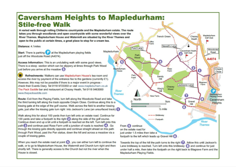
Just over 6½ km (4 miles), allow 2½ hours. Start and finish: The playing fields car park at Mapledurham.
Moderate walk: 4½ miles (7.2km), common land, farmland and woodland, allow 2¼ hours. Start and finish: Lane End Car Park or the Chequers Pub, Wheeler End Common.
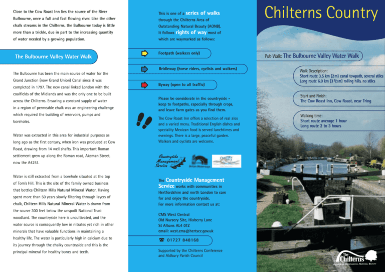
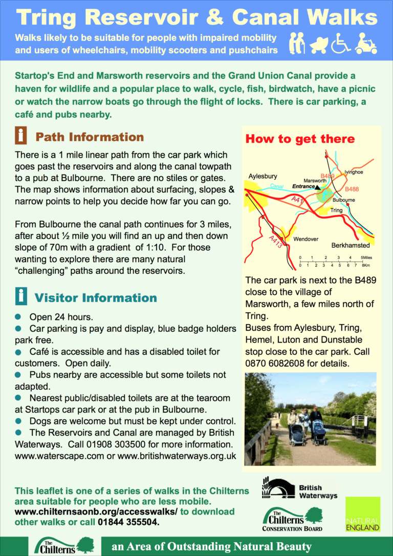
Short walk: 2 miles (3.5km) canal towpath, several stiles, allow 1 hour. Long walk: 3½ miles (6km) rolling hills, no stiles, allow 2-3 hours. Start and finish: Cow Roast Inn, near Tring HP23 5RF.
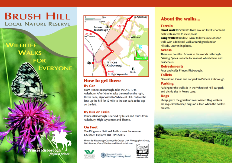
Short walk: ½ miles (0.8km). Wheelchair friendly. Long walk: 0.9 miles (1.5km), no stiles. Wheelchair friendly. Start and finish: Car park at Whiteleaf Hill.
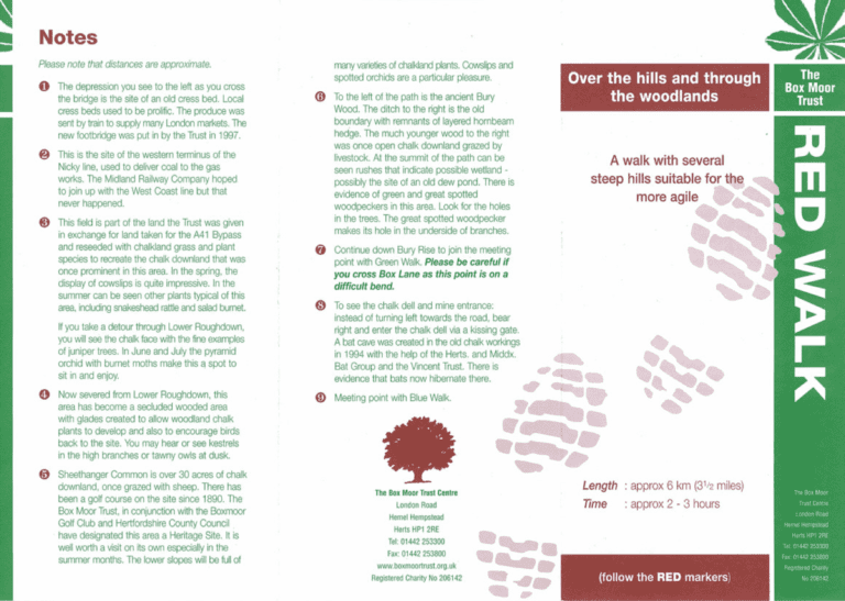
Several steep hills, suitable for the more agile: 3½ miles (6km), allow 2-3 hours. Start and finish: Plough Gardens next to Hemel Hempstead Cricket Club.
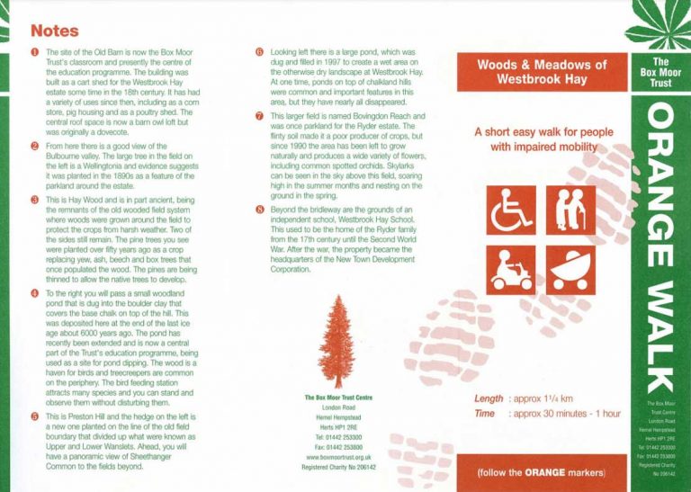
Short, easy walk: ¾ mile (1¼km), allow 30-60 mins. Wheelchair friendly. Start and finish: Car park next to the Old Barn near A4251 (London Road).
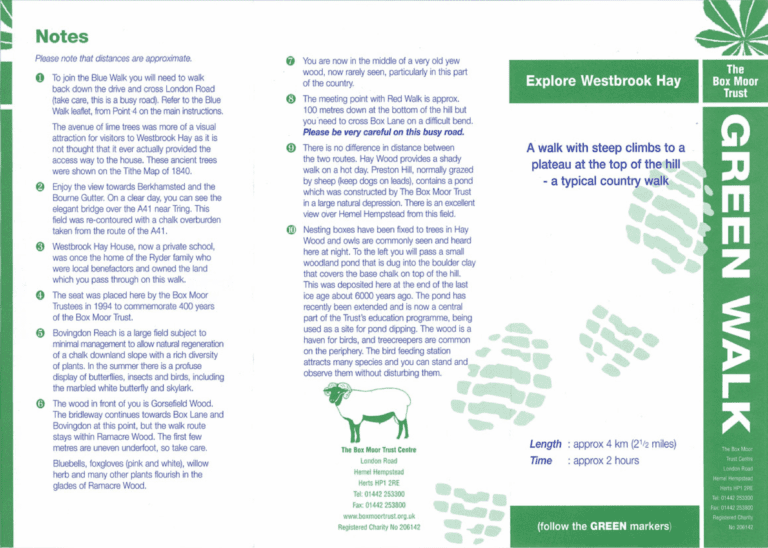
Westbrook Hay, a walk with steep climbs: 2½ miles (4km), allow 2 hours. Start and finish: Box Moor Trust Centre car park HP1 2RE.
Short walk: 2½ miles (4km), no stiles, allow 2 hours. Start and finish: Heath Lane by St John’s Church, Boxmoor HP1 1JY.
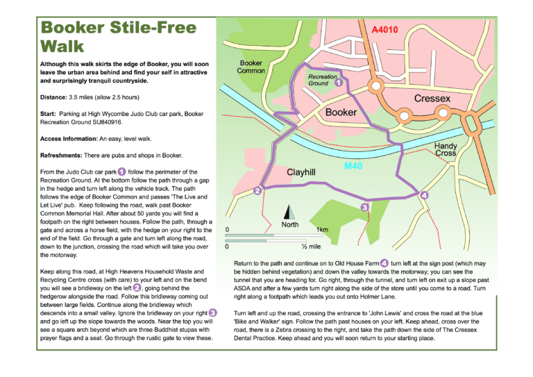
An easy, level walk: 3½ miles (5.6km), allow 2½ hours. Start and finish: High Wycombe Judo Club Car Park.
Short stile-free walk 2 miles (3km), allow 1 hour. Start and finish: Lane End car park near High Wycombe, HP14.
Short walk: 2 miles (3km), no stiles, allow 45 mins.Wheelchair friendly. Medium walk: 4 miles (6km), no stiles, allow 1½ hours. Long walk: 6 miles (10km), no stiles, allow 2½ hours. Start and finish: Berkhamsted Railway Station.
Long walk: 8 km (5 miles), allow 2½ hours. Short walk: 3 km (2 miles), allow 1 hour. Start and finish: The Greyhound, Chesham Road, Wigginton, Herts.
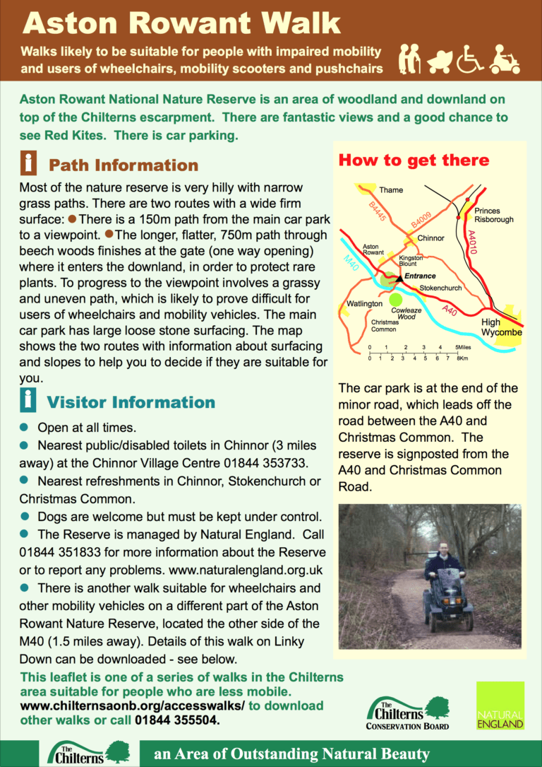
150 m (165 yd) path from the main car park to a viewpoint and longer, flatter, 750 m (820 yd) path through beech woods.
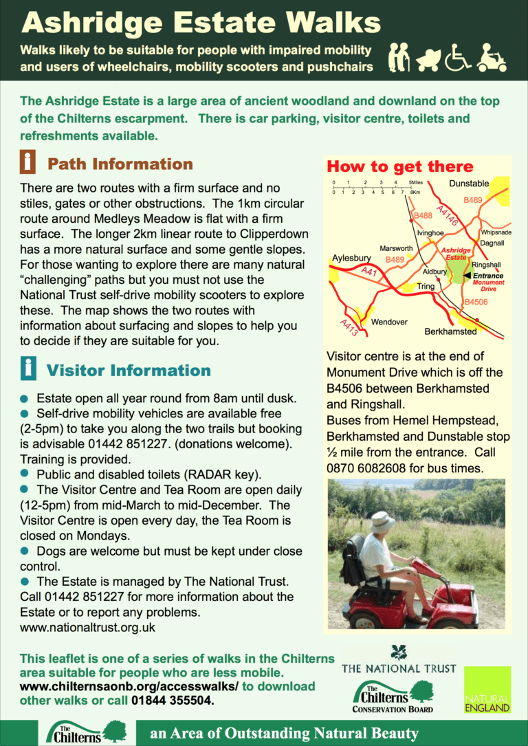
A 1 km (½ mile) circular route around Medleys Meadow and a longer 2 km (1¼ mile) linear route.
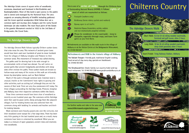
Short walk: 6½ km (4 miles), allow 2 hours. Long walk: 10 km (6 miles), allow 3 hours. Start and finish: Tring Railway Station, Aldbury.
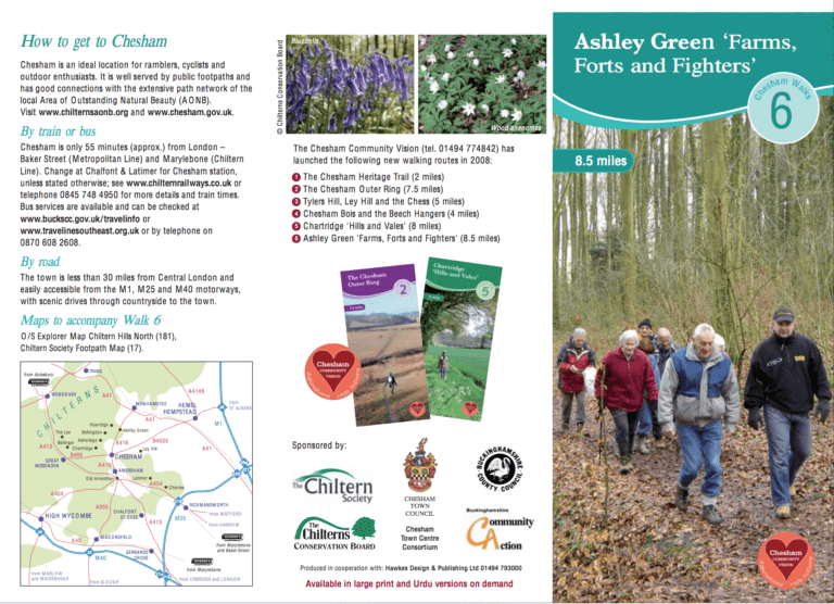
This is a 13½ km (8½ mile) walk into history; whether it is ancient history with an iron age fort or a reminder of a more modern conflict, a Second World War airfield where USAF bombers took off on their…
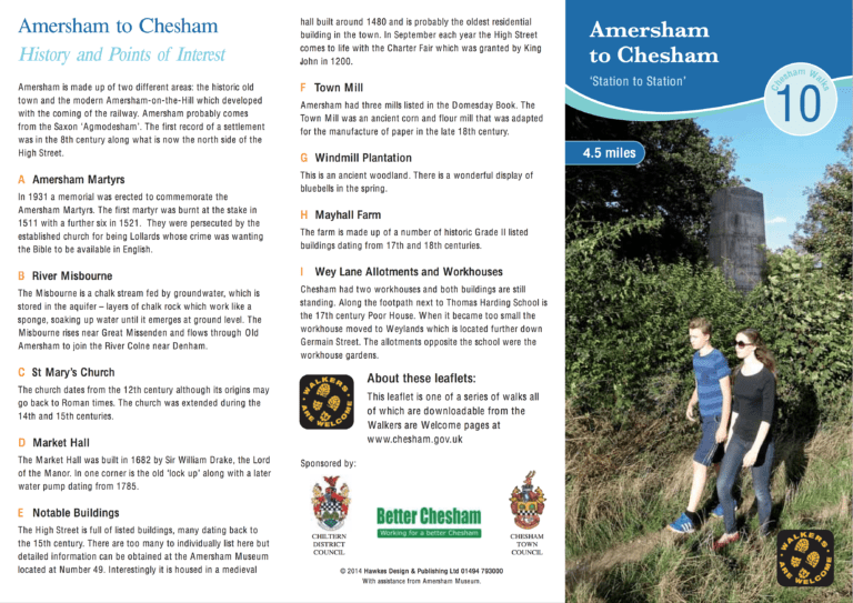
This 7.2 km (4½ mile) walk starts at Amersham station and finishes at Chesham, both on the Metropolitan Line. Several interesting waypoints are all described in the leaflet, including: a memorial to the Amersham Martyrs, a 17th century market hall…
This download includes map, description and 5-page illustrated guide to the route. Shorter route: 5¼ miles (8.5 km), allow 2½ hours. With extension to pub and hotel: 6¼ miles (10 km), allow 2¾ hours. Start and finish: The Green or…