Discover the Chilterns with Visorando, an easy to use yet sophisticated leisure mapping app. Walk, bike or even run across stunning paths throughout the Chilterns and find the route that’s right for you. The app allows you to view your position on a detailed map and use the navigation system to follow a route.
The Chiltern Society have published over 50 routes on Visorando and are adding more each month. They can be found on the App, by searching on the Visorando website, or visit:
It’s so simple to use, and you can be on your way with the 3 easy steps below.
A subscription to Visorando Club gives you access to OS Explorer & Landranger maps for Great Britain and ‘Premium’ features. You can use Visorando free with OpenStreetMap maps.
Download the Visorando app free from your Android or Apple app store. Create a user account on the App – you do not need to sign-up for a subscription.
2 Find a walk
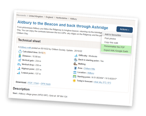
Go to the Visorando Website.* Make sure you are logged on, then visit the Chiltern Society Page to see a list of our walks. When you find a walk you like, ‘Favourite’ it by selecting Actions > Add to favourites. Your chosen route will be sent to your phone. * You can also search in the App.
3 Follow the route
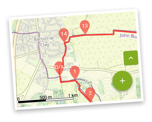
Your chosen routes will appear under Favourite in the main menu. Select route and go to the start point. Tap the green + circle then ‘Start the walk’ to navigate along the route on a map.
With the OS Maps App you know where you are at all times.