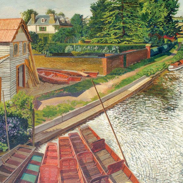
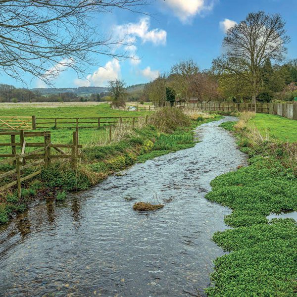
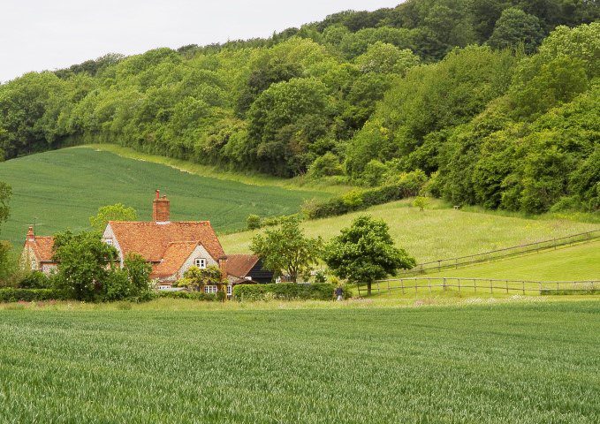
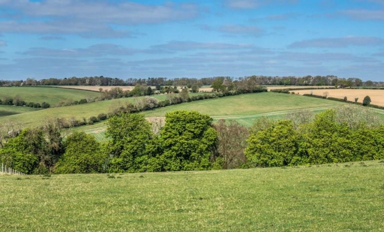
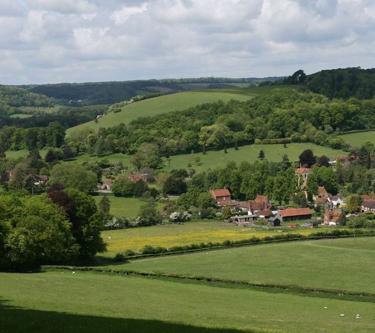
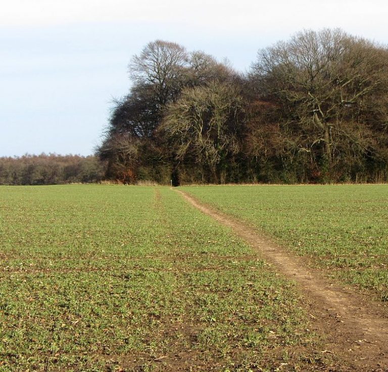
Wheathampstead to Brocket Hall
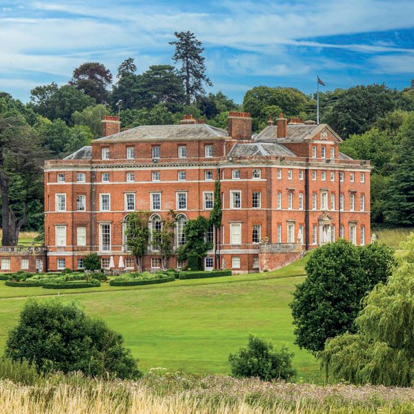
A longer than usual walk that includes much local history, rolling countryside, the upper reaches of the River Lea and two lovely pubs.
A longer than usual walk that includes much local history, rolling countryside, the upper reaches of the River Lea and two lovely pubs.
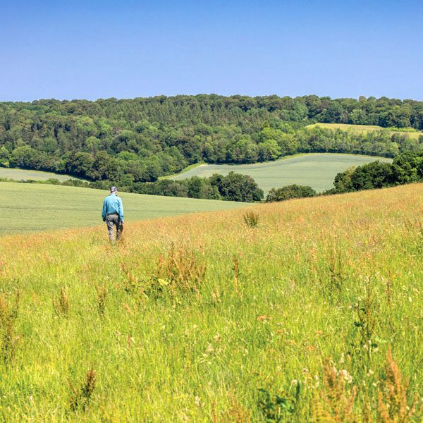
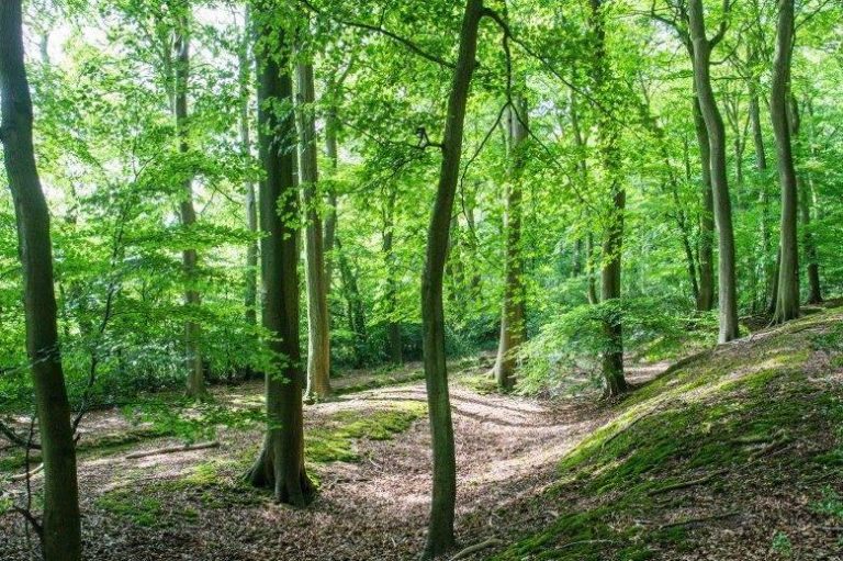
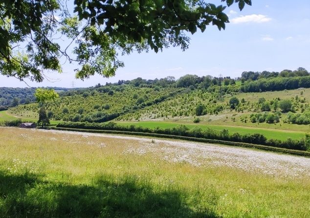
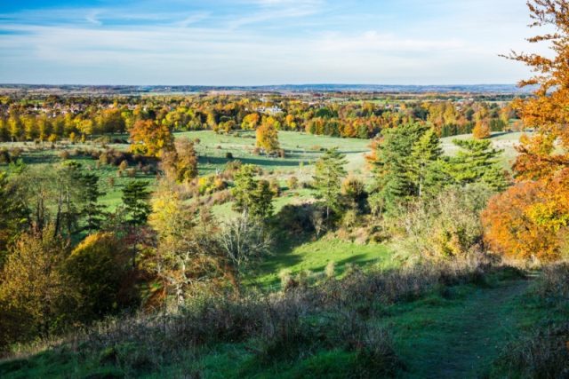
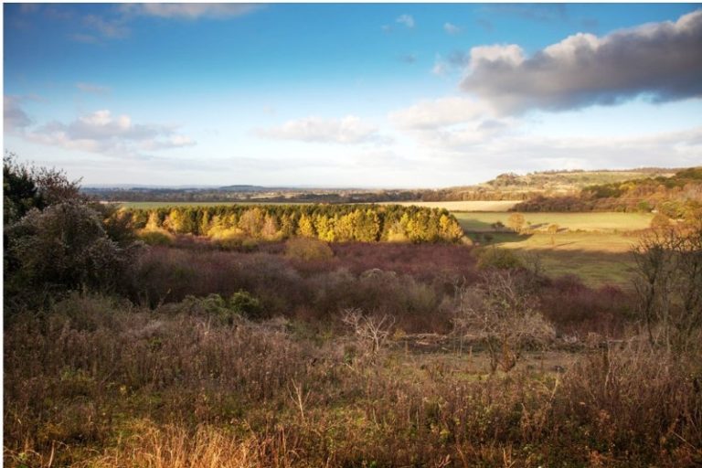
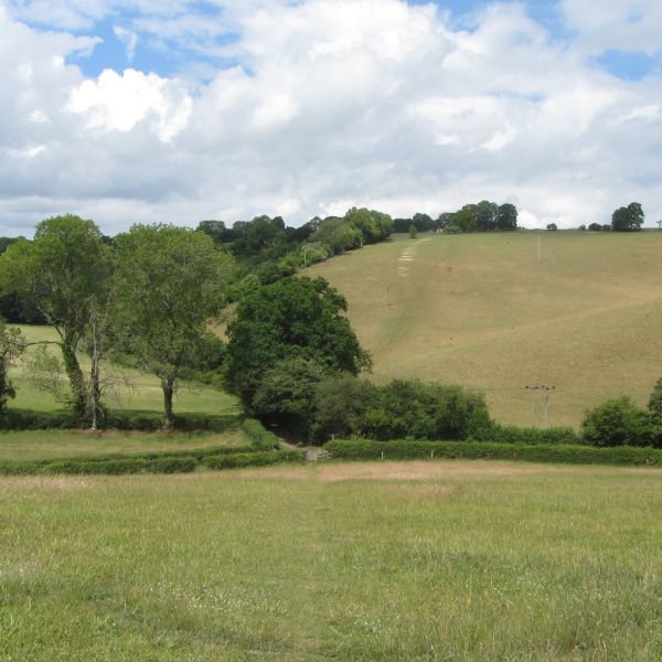
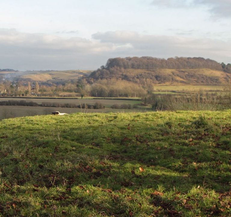
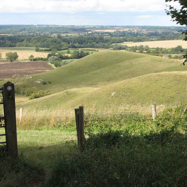
A classic Chilterns walk of rolling countryside, woodlands and stunning views.
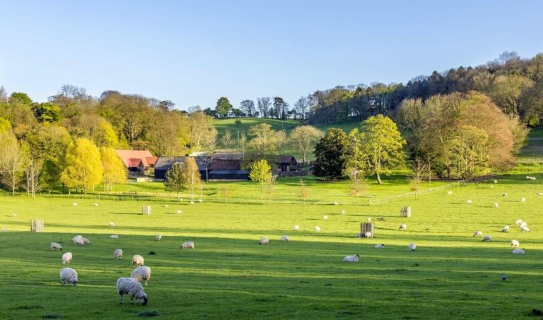
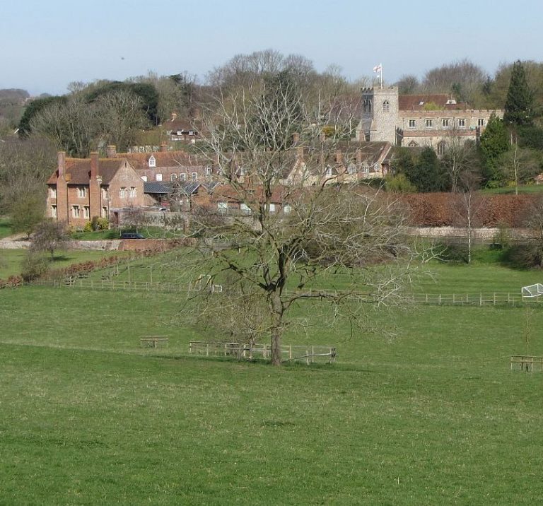
This varied walk starts from a historic farm, enjoys sweeping views and looks at some important local history. You can finish the walk with some of the best cake in the area.
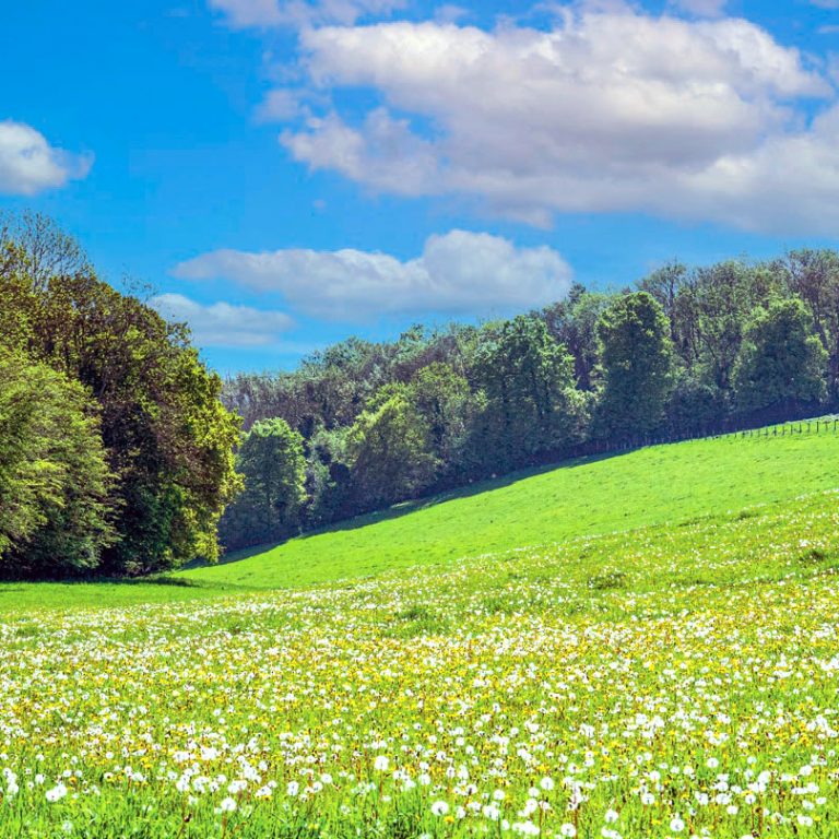
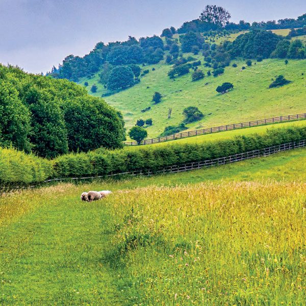
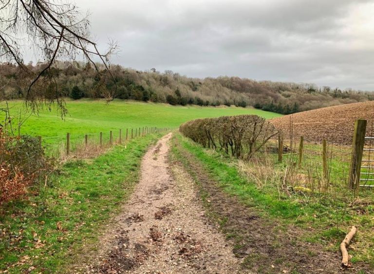
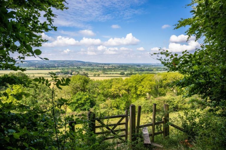
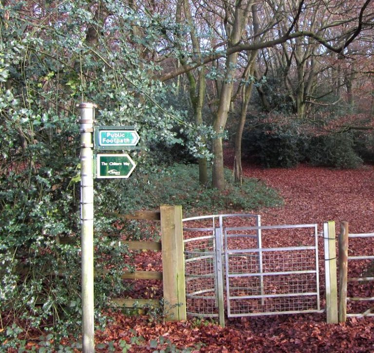
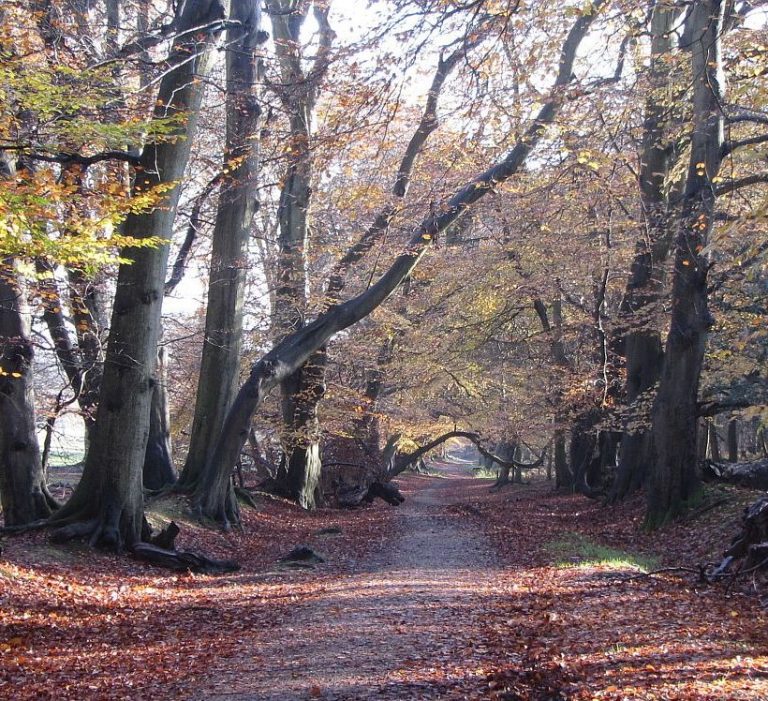
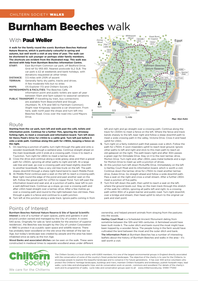
Thanks to the Society’s Donate-a-Gate scheme you can now experience open fields, lovely beech woodland and the peace and quiet of classic Chilterns countryside, all without the need to clamber over stiles.
This walk will take you round Sir Stanley Spencer’s home village, a place he regarded as ‘heaven on earth’. It also ventures into thesurrounding countryside and along the Thames.
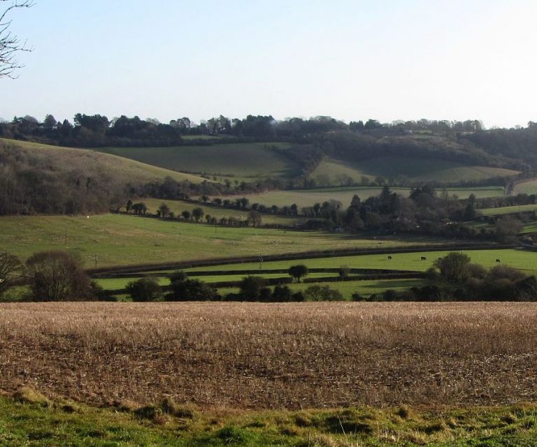
A lovely route to the south of Redbourn with good views and pleasant walking through the Ver Valley. This area is steeped in history from ancient Britons to the present day.
This walk takes you through beautiful rolling countryside, past the home of an English Civil War hero and the monumenterected in his memory. It also gives you the opportunity to imagine yourself on the set of a Hammer horror film.
This could be described as a Christmas walk for all seasons, or perhaps a walk of two halves – an adventure in lovely woodland or on a breath-taking hilltop. The choice is yours.
A stile-free walk that explores the picturesque Chess Valley, the pretty village of Chenies with its Tudor manor house, 15th century church and village green, and finally delightful Chorleywood Common.
This walk is a unique opportunity both to visit two outstanding Sites of Special Scientific Interest and view the location of one of the issues that led to the founding of the Chiltern Society. Aston Rowant and Shirburn Hill host…
A stile-free walk rich in wildlife and history, with outstanding views over the local countryside.
A choice of stile-free walks visiting Aldbury, Ashridge and Tring Park. Easy walking on good paths with some hills.
A very scenic walk that takes in rolling chalk hills, sweeping views and beech woodland. There’s an option to visit the ancient Radnage church and Yoesden Bank, a wonderful example of traditional Chiltern landscape.
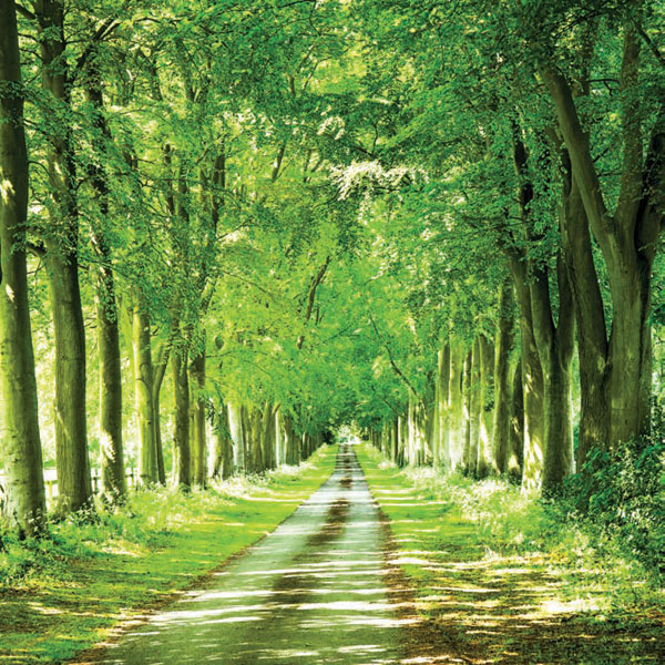
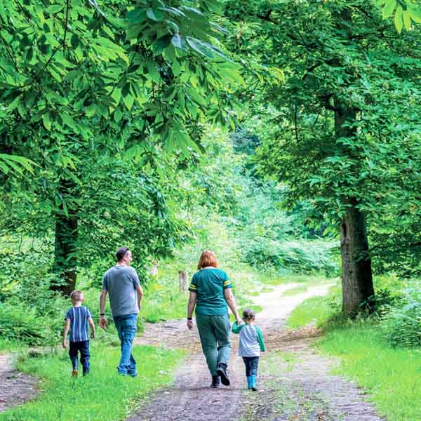
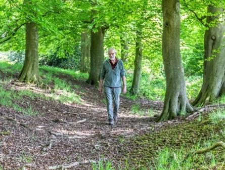
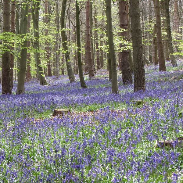
On the edge of the Chilterns you find what’s now the largest continuous new native forest in England. We’ve chosen a route that features some of the best scenery throughout the year and has a magnificent display of bluebells in…
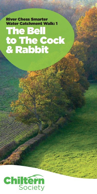
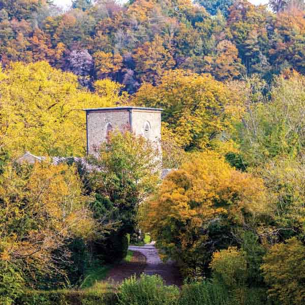
Stage 1 of an 11 mile circular route between pubs to the NW of Chesham. This stage is 2.5 miles starting at The Bell, Chartridge and finishing at The Cock & Rabbit, The Lee (NB. The Bell is currently closed).
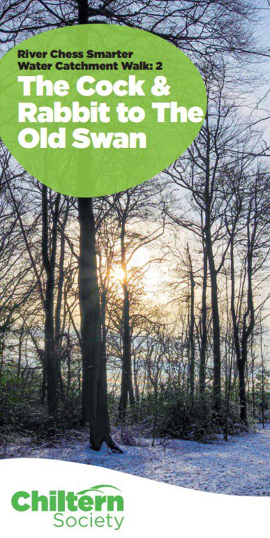
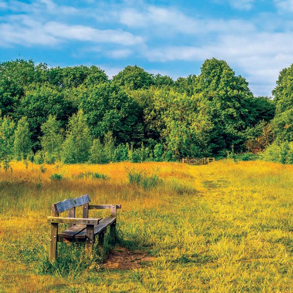
Stage 2 of an 11 mile circular route between pubs to the NW of Chesham. This stage is 1.1 miles starting at The Cock & Rabbit, The Lee and finishing at The Old Swan, Swan Bottom.
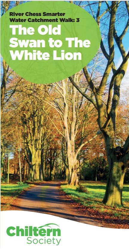
Stage 3 of an 11 mile circular route between pubs to the NW of Chesham. This stage is 1.1 miles starting at The Old Swan, Swan Bottom and finishing at The White Lion, St Leonards.
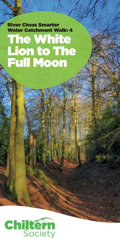
Stage 4 of an 11 mile circular route between pubs to the NW of Chesham. This stage is 2.2 miles starting at The White Lion, St Leonards and finishing at The Full Moon, Hawridge.
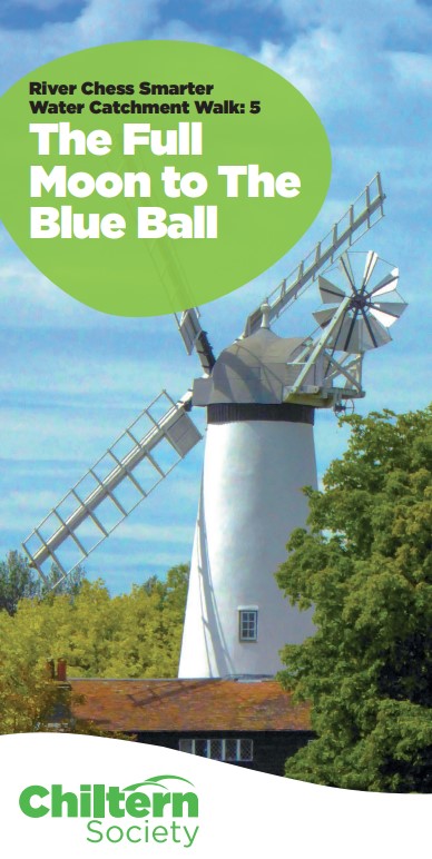
Stage 5 of an 11 mile circular route between pubs to the NW of Chesham. This stage is 2 miles starting at Full Moon, Hawridge and finishing at the The Blue Ball, Asheridge.
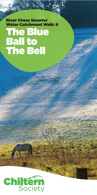
Stage 6 of an 11 mile circular route between pubs to the NW of Chesham. This stage is 0.85 miles starting at The Blue Ball, Asheridge and finishing at The Bell, Chartridge (pub currently closed).
Climb out of the Gade valley then head south through villages, fields and woodland. Cross the Chess near Sarratt and pass the Chiltern Open Air Museum on the way to Chalfont St Giles.
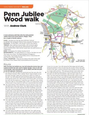
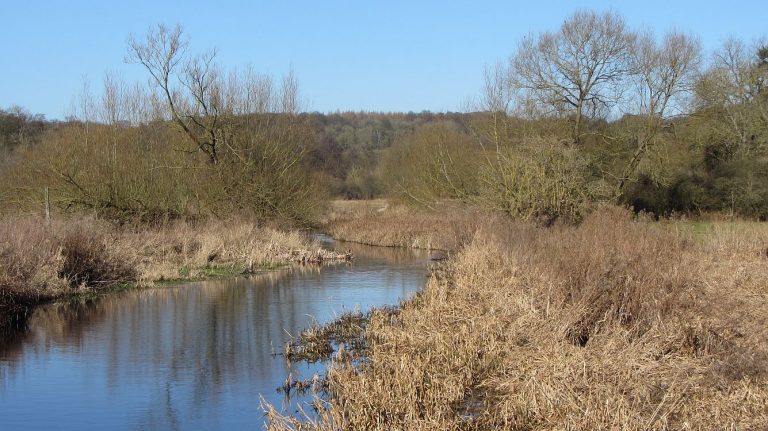
A more challenging walk through woods and fields that also has a couple of more gentle options. The highlight is a visit to the fairly recently planted Penn Diamond Jubilee Wood and the opportunity to sample the food and drink…
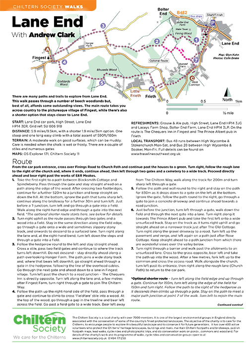
A 5.9 mile route that explores the many paths and trails from Lane End. There are some outstanding views. 180m of ascent.
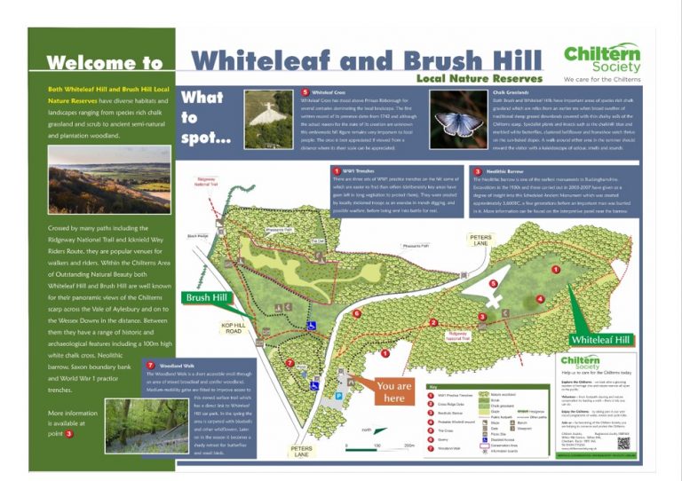
This 2 mile walk explores two of the Chiltern Society’s most important nature reserves. It’s easy walking but there is one steep climb. Both sites provide fantastic panoramic views of the Chilterns escarpment, Vale of Aylesbury and further
An opportunity to visit the picturesque village green at The Lee using a mixture of footpaths and tracks through fields and woodland. There are 2.5 and 4.5 miles options. One of a series of Social Distancing walks.
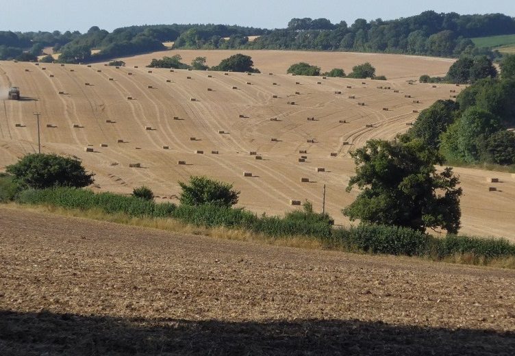
This undulating stile free 5.5 walk explores the Chilterns countryside around the south Oxfordshire village of Binfield Heath. Look out for historic cottages, a former deer park and evidence of past brick making. There is also plenty of flora and…
A 4 mile circular walk on good paths in hilly countryside with some lovely views. The route includes woodland, meadows and open farmland. One of a series of Social Distancing walks.
The Chilterns are well known for their beech woodlands. This gentle 2.5 mile stile free walk goes through some of the best of them enabling you to appreciate their beauty and take in some lovely views over the Chess Valley.
This scenic gently undulating 2.8 stile-free walk takes you through a variety of habitats. One of a series of Social Distancing walk.
A lovely 5 miles stile-free walk that explores the hills and woodlands that overlook the beautiful market town of Henley-on-Thames. The first section of the walk is across high parkland with excellent views, the return is through woodland.
The parish of Kimpton is criss-crossed by an extensive of public rights of way, some of them dating from pre-Roman times. This 5.2 miles walk explores the farmland north of the village which is rich in wildlife and there are…
This 3.8 mile stile free walk to the east of Chesham explores the network of paths in beautiful rolling countryside. There are lovely views of the Chess valley and the walk passes Cowcroft Wood nature reserve where bluebells and wild…
Starting from the historic village of Lilley, this 4.8 mile stile free walk is a largely gentle route through farmland and chalk downland to the summit of Warden Hill. You will be rewarded with far reaching views in all directions.…
Nettlebed is in the midst of the Chilterns and a beautiful place for walking. This 6 mile walk has no stiles or kissing gates. It passes through Warburg Nature Reserve, best known for its dormouse population. There is a visitor…
This beautiful scenic 4.5 mile stile-free walk is centred on the historic Oxfordshire village of Nettlebed. It features two commons, a nature reserve and the wonderful Chiltern landscape of beech woodlands, chalk grassland and rich wildlife. One of a series…
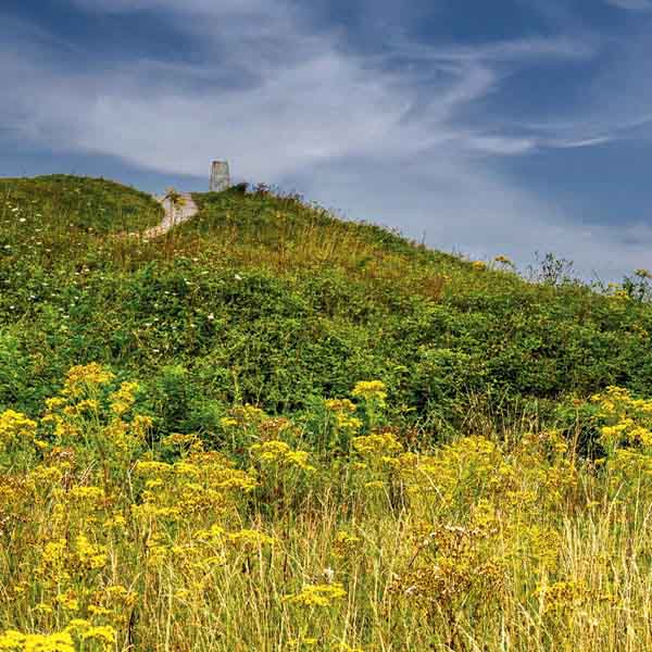
This 3.5 mile walk climbs steadily into the Pegsdon Hills Nature Reserve where you can see rare chalkland plants and butterflies. From the top you can enjoy some of the best views in the North Chilterns. One of a series…
This 6 mile stile free walk initially follows the ancient Ridgeway with stunning views from the top of Pitstone Hill before returning through the beautiful woodland of the National Trust’s Ashridge Estate. One of a series of Social Distancing walks.
This 5.1 mile stile free walk quickly leaves Prestwood and uses some of the less frequented paths to enjoy the beautiful countryside in the surrounding area.
This 3 mile starts at the Prestwood Local Nature Reserve and Picnic Site. There are views of the valleys on each side before returning through Nanfan Wood. One of a series of Social Distancing walks.
A scenic 2.1 mile stile free walk which starts in Peppard Common and follows Dog Lane and the Chiltern Way. A gentle walk on wide tracks. One of a series of Social Distancing walks.
A 4.5 mile stile free walk that passes through beautiful Chiltern valleys where red kites are abundant. You can also enjoy panoramic views, ancient beech woods and rolling farmland. One of a series of Social Distancing walks.
A 4.2 mile stile free walk from the old market town of Tring which explores both the town and the surrounding countryside. It includes a world famous museum, a magnificent village hall, a few follies and the all year round…
A 4.2 miles stile free walk that takes in some wonderful Chilterns scenery including rolling chalk downland, beech woodlands and ancient pathways. It follows stretches of both the Oxfordshire Way and the Ridgeway National Trail. One of a series of…
An easy 2.5 mile stile free walk that passes through woodland with views across the adjacent countryside before returning via the Dashwood Mausoleum and Hell Fire caves. One of a series of Social Distancing walks.
This 5 mile stile free walk takes in some great views of the urban landscape, valleys and woodland to the north and west of the historic town of Berkhamsted. One of a series of Social Distancing walks
This 6 mile walk takes in some wonderful Chilterns scenery including rolling chalk downland, beech woodlands and ancient pathways. There are far-reaching views over the Oxfordshire Vale from Aston Rowant Nature Reserve. One of a series of Social Distancing walks.
A 6.2 mile walk from the village of Great Offley that has scenic views and the opportunity to see such wildlife as red kites and buzzards, and perhaps a sparrow hawk or a hobby, or even a rare bee orchid.…
From Chalfont St Giles you follow quiet country paths over fields and through woods, passing pretty villages. You then cross the busy Wye valley and M40 before returning to rural calm and passing through larger patches of woodland before ending…
A walk, initially through woodland, then along the lovely Hambleden Valley and passing through the villages of Hambleden, Fingest and Turville. There are fine views from the hills above Fingest and Turville.
The new route of the Chiltern Way departs from the original route at Upper Bix Bottom and roughly follows the curve of the Thames south from near Henley, via Mapledurham to Goring, then north to Ewelme. It is classic walking…

Chiltern Way from Sonning Common to Whitchurch Hill via Mapledurham.
Chiltern Way from Whitchurch Hill to Woodcote via Goring.
Chiltern Way from Woodcote to Ewelme.
This quiet, relatively remote, stage of the Chiltern Way offers fine views across the Oxford Plain from the downs above Ewelme before continuing northwards through mainly broad-leaf woodland.
Explore the pretty ridges, valleys and woods past Radnage and over Bledlow Ridge. Cross the broad Risborough Gap and continue through quiet woods and remote hamlets. Note the stage finish has changed because of HS2 works.
Climb out of the Misbourne Valley then walk field paths through remote hamlets and woods. Follow the line of Grim’s ditch before crossing the “Tring Gap” to the edge of Aldbury. Route updated for HS2 works.
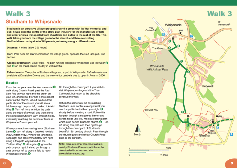
Walk through the woods of the Ashridge estate and then cross the Gade valley to Studham. You pass Whipsnade Zoo and the tree cathedral before enjoying the spectacular views from Dunstable Downs.
After skirting Houghton Regis and crossing the M1 you can enjoy fine stretches of open downland around Sundon before reaching the beech hangers above Sharpenhoe and its attractive iron age fort.
A walk through several of the finest nature reserves in the North Chilterns linked by the ancient Icknield Way track. Delightful walking, often on hills reminiscent of the South Downs.
Walk from Great Offley to Peters Green crossing the north-eastern end of the Chilterns. The countryside feels remote and quiet despite passing only 2 miles from the A1M and Stevenage.
After crossing the Lea Valley the route uses converted railway lines to pass through Harpenden to Redbourn. Cross the M1 before a stretch of pretty, quiet countryside after the village of Flamstead. You cross the lovely Gade valley, finishing with…
This is classic walking in South Oxfordshire, farm country and woodland, with frequent, open views over the Thames valley to the South and later across the Oxfordshire Plain.
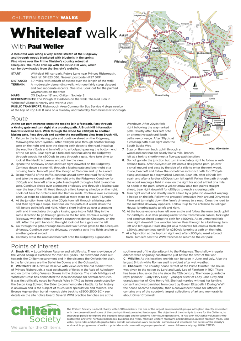
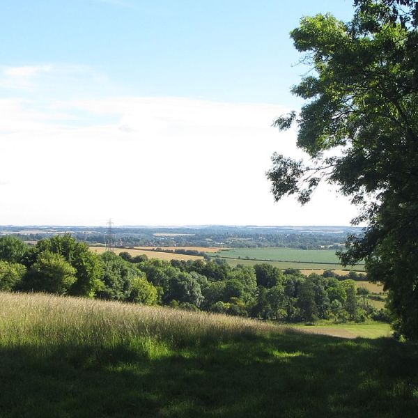
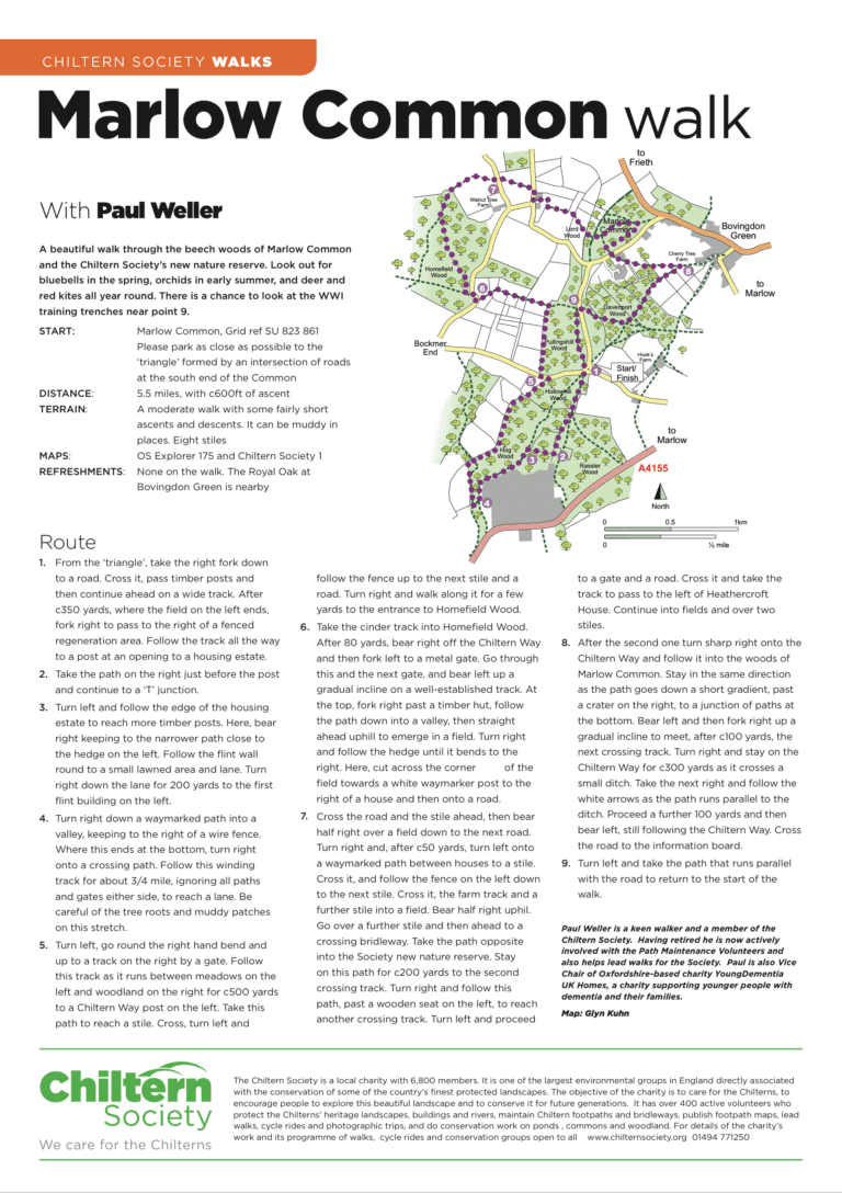
5.7 miles, with c900ft of ascent over the length of the walk. A moderately demanding walk, with one fairly steep descent and two moderate ascents. One stile. Look out for the painted waymarkers on the trees. Download a PDF for…
6½ km (4 miles), allow 2½ hours. Start and finish: Car park at the Tree Cathedral, Whipsnade.
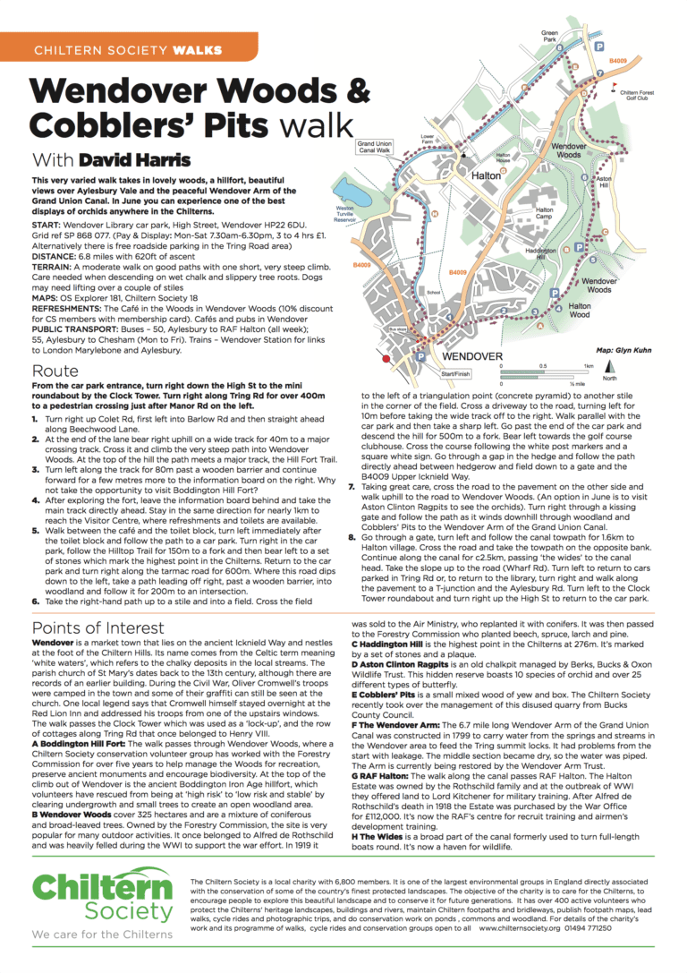
6.8 miles with 620ft of ascent A moderate walk on good paths with one short, very steep climb. Care needed when descending on wet chalk and slippery tree roots. Dogs may need lifting over a couple of stiles.
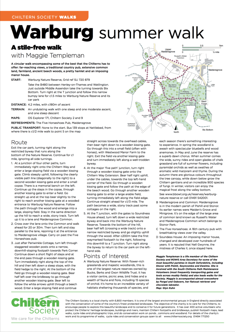
4.2 miles, with c180m of ascent. An undulating walk with one steep and one moderate ascent, and one steep descent.
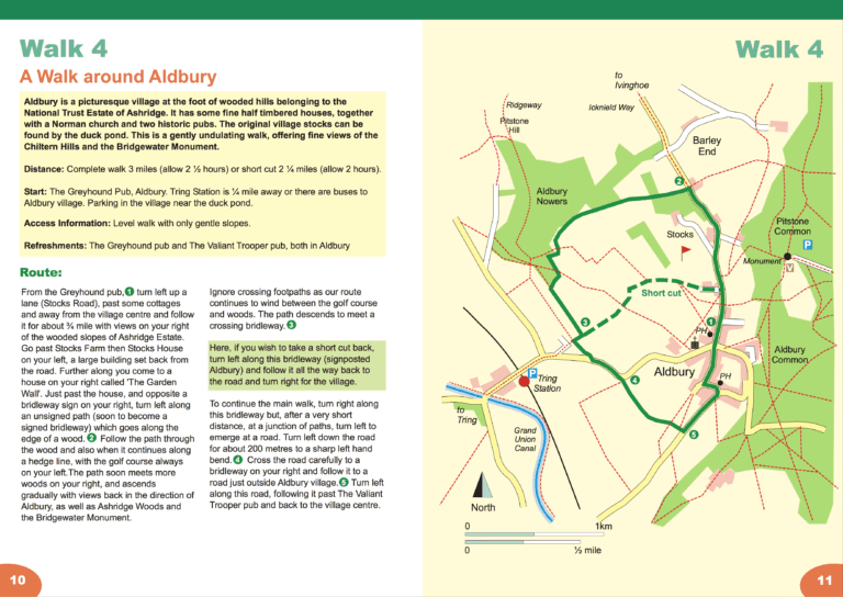
Complete walk 5 km (3 miles), allow 2½ hours, or with short-cut 3½ km (2¼ miles), allow 2 hours. Start and finish: The Greyhound Pub, Aldbury.
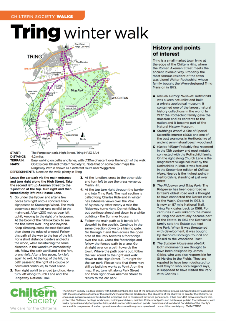
4.2 miles. Easy walking on paths and lanes, with c130m of ascent over the length of the walk.
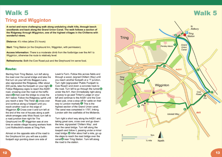
7 km (4¼ miles), allow 2¼ hours. Start and finish: Tring Station or the Greyhound Inn, Wigginton, with permission.
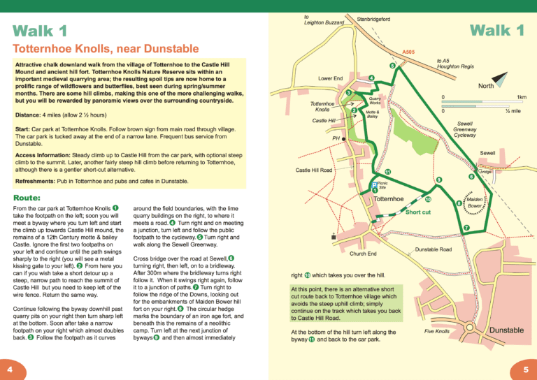
6½ km (4 miles), allow 2½ hours. Start and finish: Car park at Totternhoe Knolls.
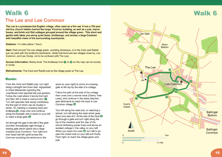
7 km (4¼ miles), allow 2¼ hours. Start and finish: Park at The Lee (not Lee Common or Lee Clump) village green, avoiding driveways, or in the Cock and Rabbit car park with the landlord’s permission.
5.5 miles, with c130m of ascent. An easy walk with one steep climb and one steep descent.
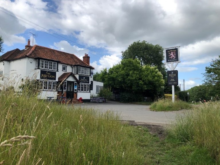
6½ km (4 miles), allow 2½ hours. Start and finish: Park near the War memorial on the village green, opposite the Red Lion.
6.5 miles, with 475ft/145m of ascent. A moderate walk with steady ascents and descents. Paths are generally good, but the sections through woodland can be very muddy in wet conditions.
5.8 miles with 250ft of ascent. An easy walk with two gentle climbs and one steep descent.
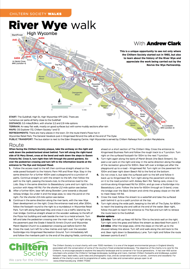
5.5 miles, with shorter 2.2 and 2.9 mile options. An easy flat walk, mostly on good surfaces but with some muddy sections after rain.
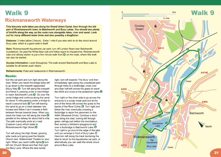
5 or 6½ km (3 or 4 miles), allow 1½ or 2 hours. Start and finish: Rickmansworth Aquadrome car park.
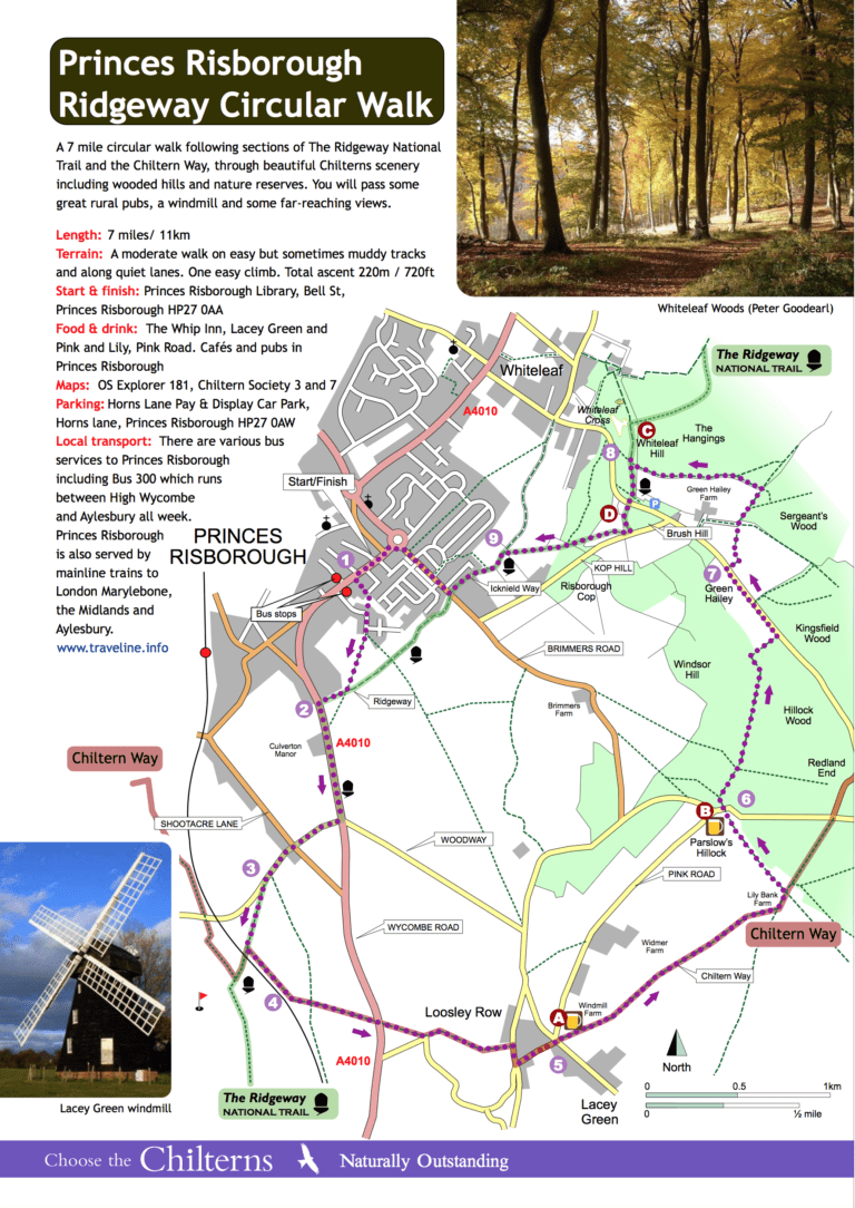
A 7 mile circular walk following sections of The Ridgeway National Trail and the Chiltern Way, through beautiful Chilterns scenery including wooded hills and nature reserves. You will pass some great rural pubs, a windmill and some far-reaching views.
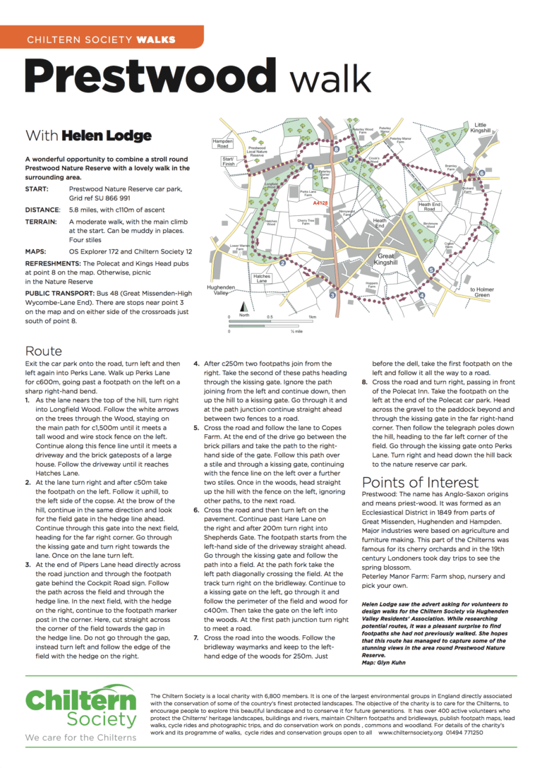
5.8 miles, with c110m of ascent A moderate walk, with the main climb at the start. Can be muddy in places. Four stiles.
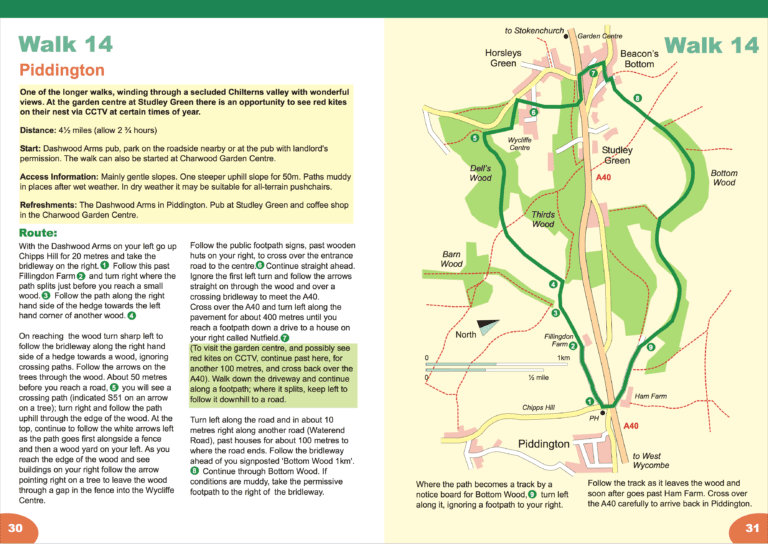
7 km (4½ miles), allow 1¾ hours. Start and finish: Dashwood Arms.
5 miles. A moderate walk, with c600ft of ascent over its length. No stiles. There is a more strenuous option which adds an extra 160ft of ascent.
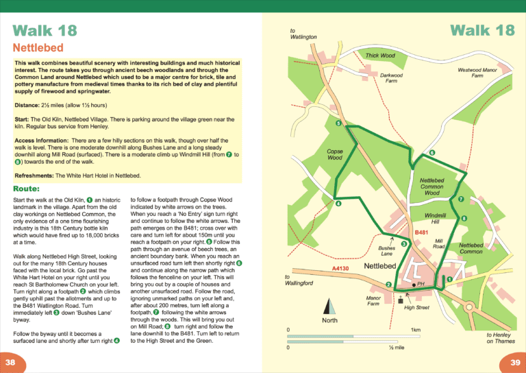
4 km (2½ miles), allow 1½ hours. Start and finish: The Old Kiln, Nettlebed Village.
4.7 miles with 160ft of ascent. There is also a shorter 3 mile option. An easy waterside walk.
5.5 miles, with c600ft of ascent. A moderate walk with some fairly short ascents and descents. It can be muddy in places. Eight stiles.
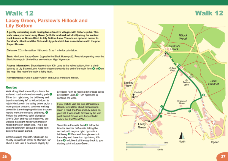
Short walk: 2½ miles (4km), gently undulating circular walk, allow 1½ hours. Start and finish: Kiln Lane, Lacey Green.
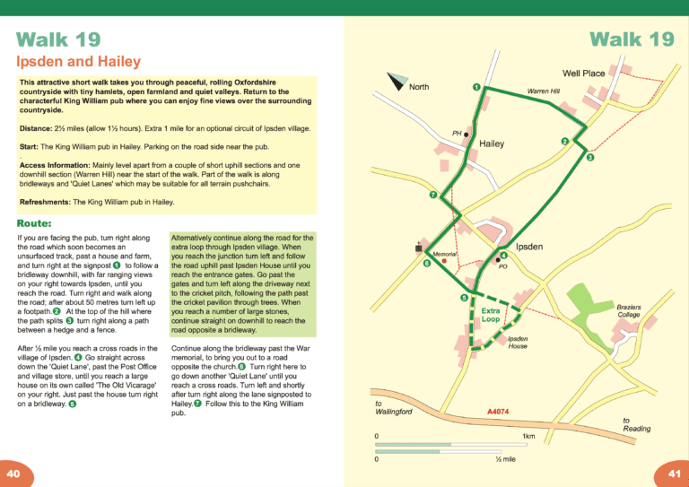
4 and 5 km (2½ and 3 miles), allow 1½ hours. Start and finish: The King William, Hailey.
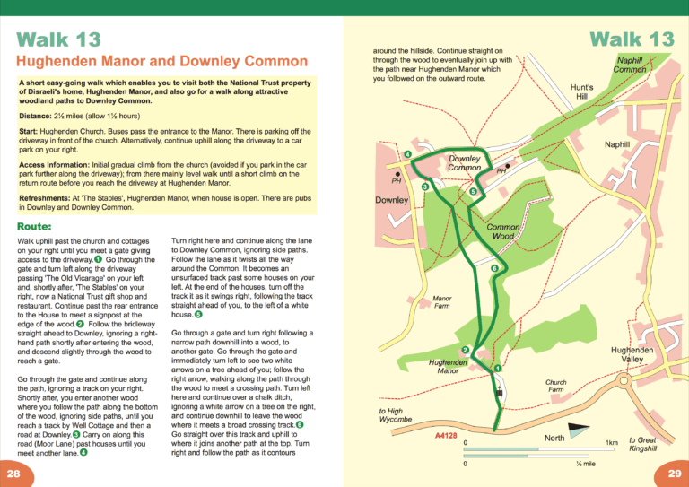
4 km (2½ miles), allow 1½ hours. Start and finish: Hughenden Church.
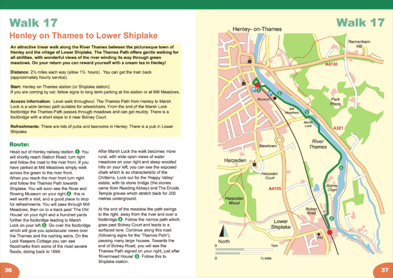
4 km (2½ miles), allow 1½ hours. Start and finish: Henley-on-Thames or Shiplake railway stations.
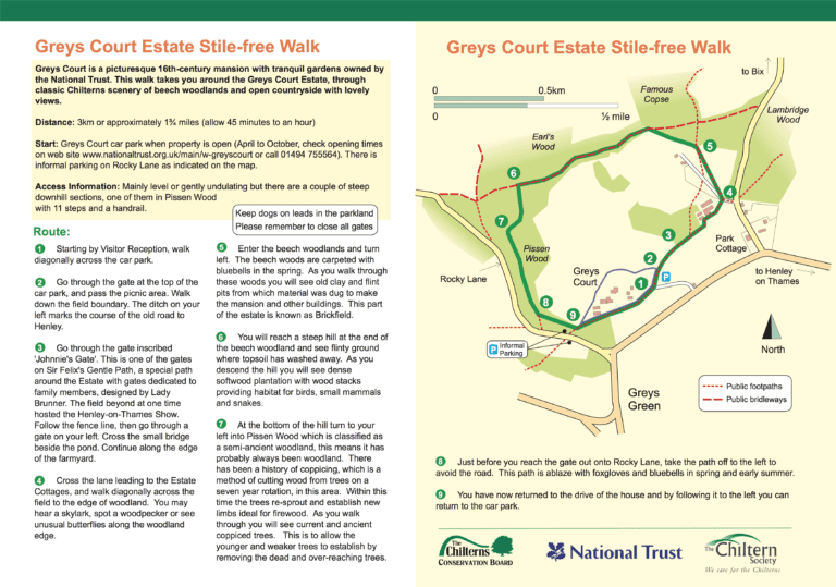
Short walk: 1¾ miles (3km), undulating woodland and open countryside walk, 2 steep descents, allow 45 minutes. Start and finish: Greys Court Car Park.
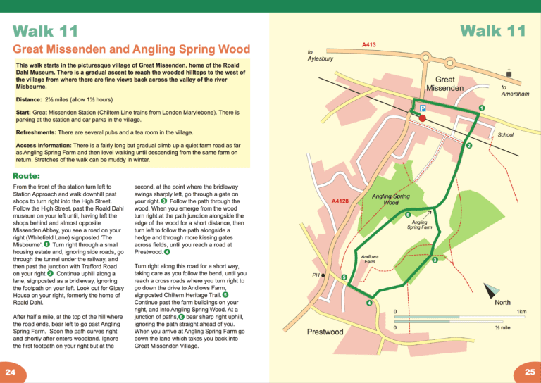
4 km (2½ miles), allow 1½ hours. Start and finish: Great Missenden railway station.
5.5 miles with 630ft of ascent. A moderate walk with three climbs.
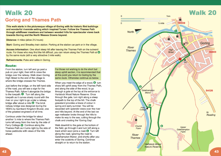
6½ km (4 miles), allow 2½ hours. Start and finish: Goring and Streatley railway station.
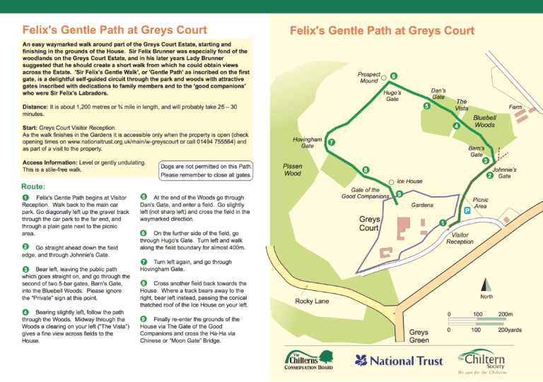
Short walk: ¾ mile (1.2km) accessible only when the property is open, easy waymarked path, allow 30 minutes. Start and finish: Greys Court Visitor Reception.
4.7 miles with 590ft of ascent. A moderate stile-free walk on easy, but sometimes muddy, tracks. One steep climb.
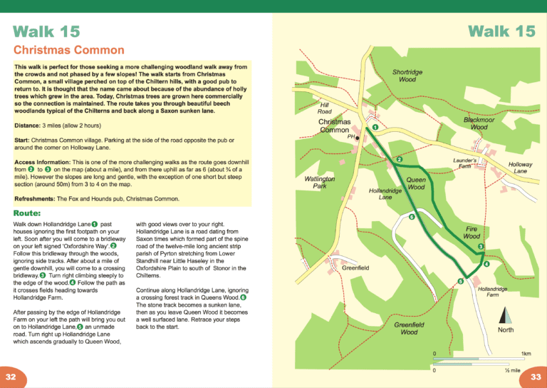
5 km (3 miles), allow 2 hours. Start and finish: Christmas Common.
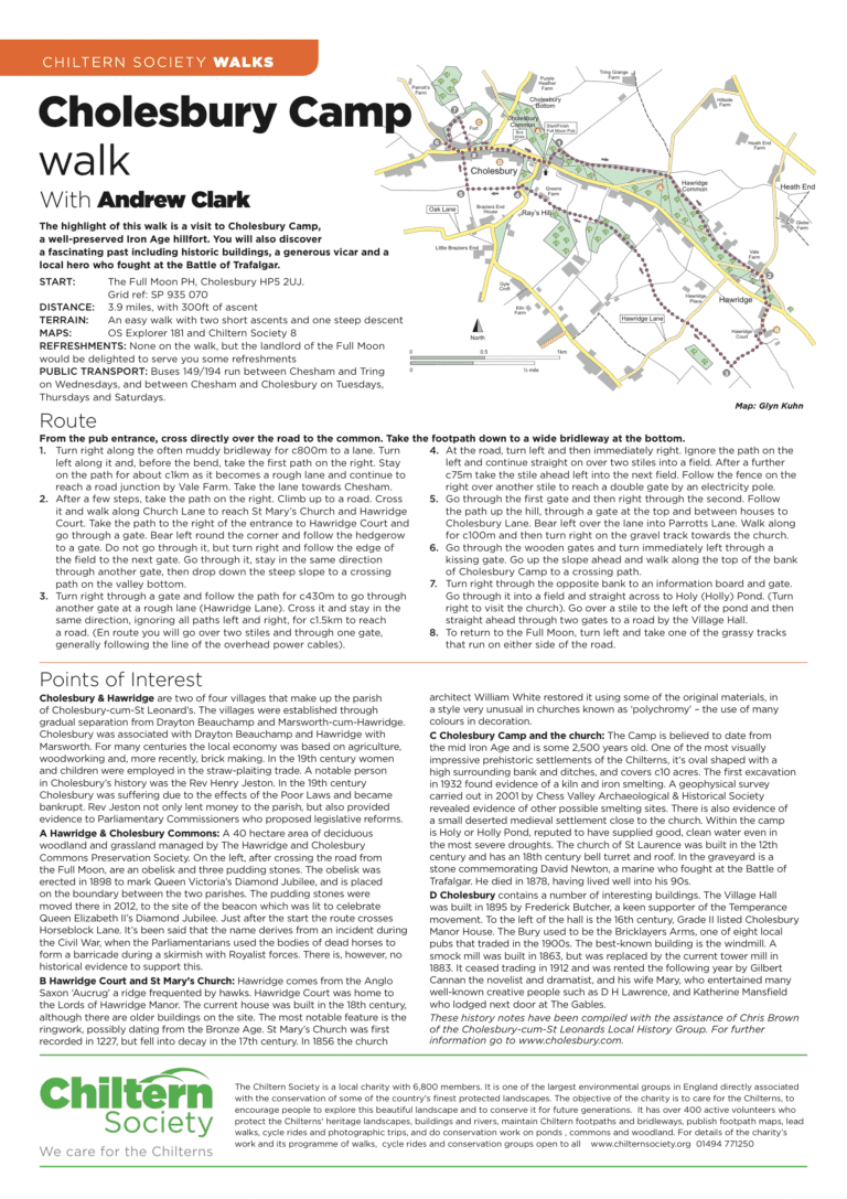
3.9 miles, with 300ft of ascent. An easy walk with two short ascents and one steep descent.
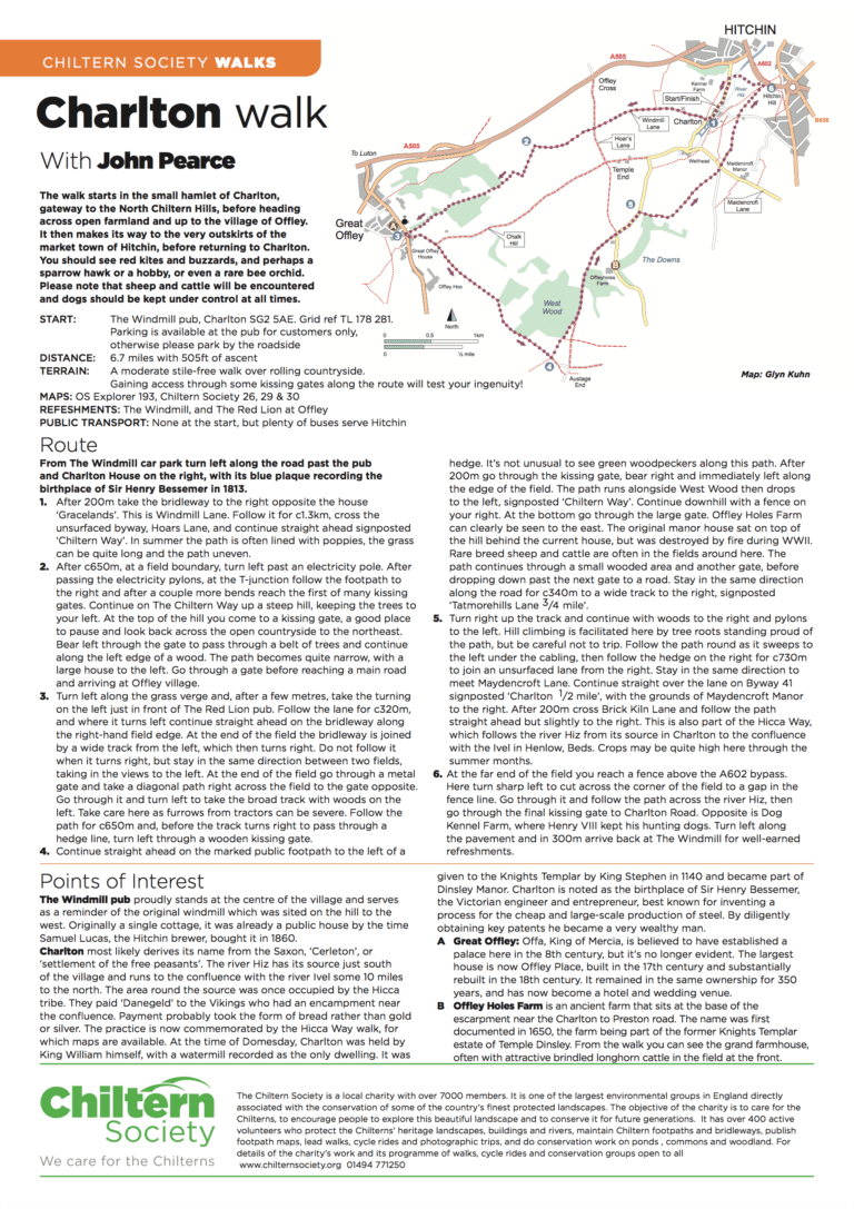
6.7 miles with 505ft of ascent A moderate stile-free walk over rolling countryside. Gaining access through some kissing gates along the route will test your ingenuity!

5 miles with 290ft of ascent. A gentle walk with one easy climb. Woodland paths can be muddy at times.
3.5 miles with 210ft of ascent Generally fairly dry paths, tracks and drives. A few moderate hills but no stiles.
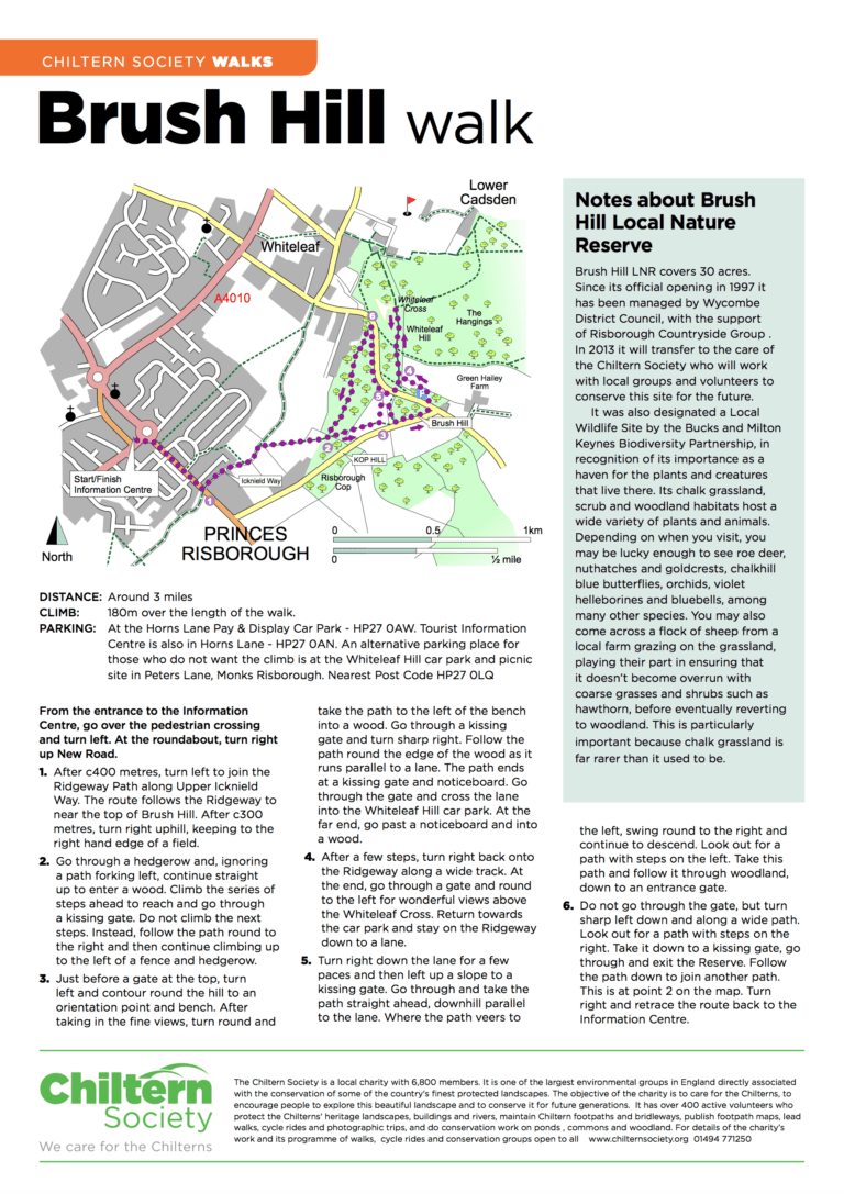
This 3 mile stile free walk takes in two Chiltern Society nature reserves that have some of the finest views in the area. 180m of ascent.
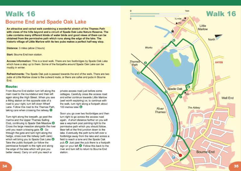
5 km (3 miles), allow 2 hours. Start and finish: Bourne End railway station.
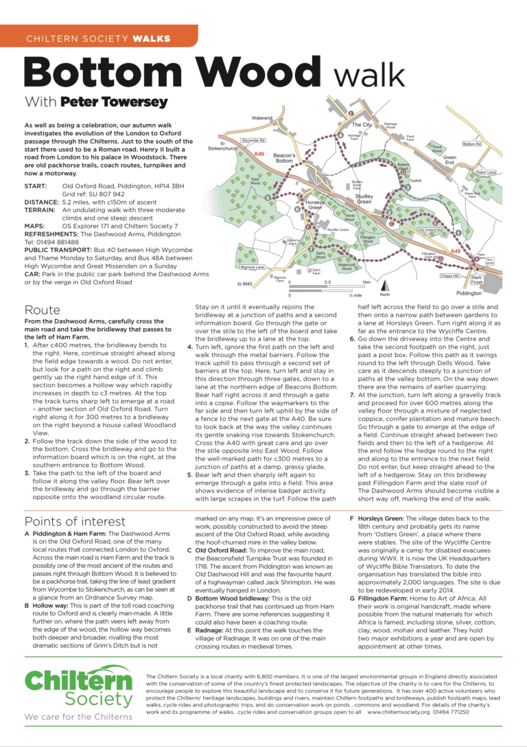
5.2 miles, with c150m of ascent. An undulating walk with three moderate climbs and one steep descent
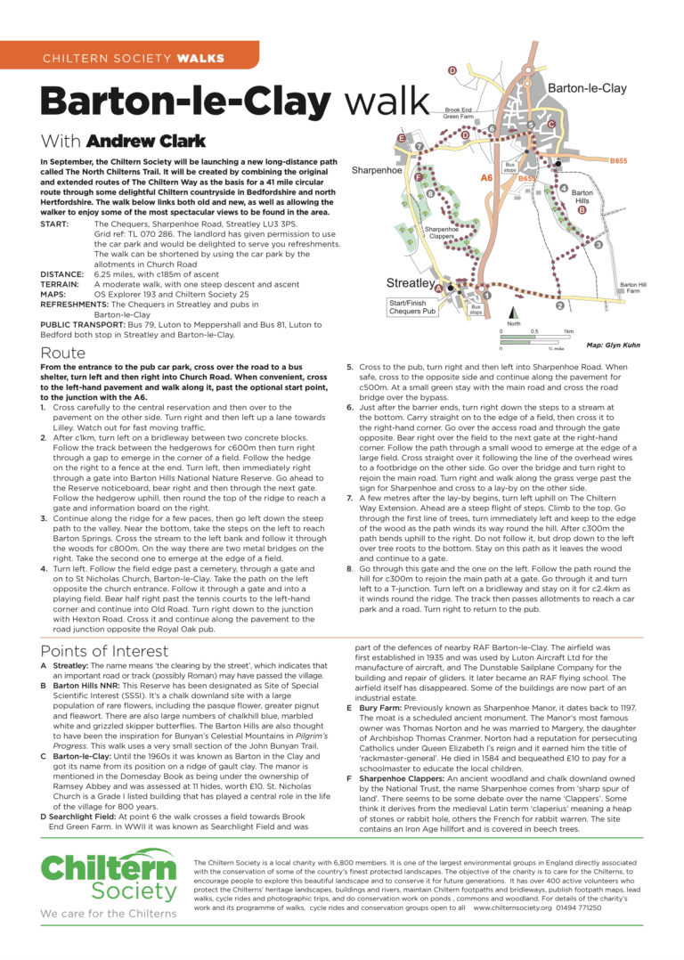
6.25 miles, with c185m of ascent . A moderate walk, with one steep descent and ascent .
4.6 miles, with 110m of ascent over the length of the walk. An easy walk that can be muddy after rain.
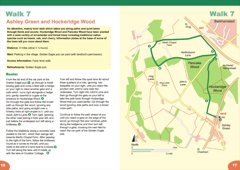
6½ km (4 miles), allow 2½ hours. Start and finish: Parking in the village. Golden Eagle pub car park with landlord’s permission.
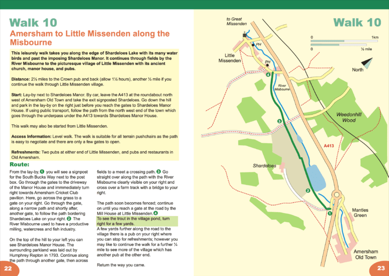
4 or 5 km (2½ or 3 miles), allow 1 to 1½ hours. Start and finish: Lay-by next to Shardeloes Manor.
The Northern Link follows the original, superceded, route of the Chiltern Way. From the beech hangers of Sharpenhoe Clappers, you head to the Galley and Warden Hills, from where you get extensive views over Luton. You then thread your way…