Using technology to support and promote the Chilterns landscape
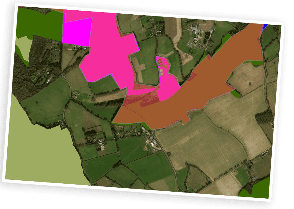
Nowadays, a lot of information concerning the human and natural environment, heritage, planning and construction projects such as HS2, is published as geographical data which can be overlaid onto maps and satellite images. This data can be collected in the field as part of a project, or supplied and shared by central and local government, academic and environmental agencies. Enabling the Chiltern Society to be able to create its own GIS system and map information relating to the Chiltern area, will enhance our ability to support and promote the Chilterns. Being able to make use of this information will allow us to better assess the impact of historical, current and future development on our unique landscape, and be able to publish information in the form of maps.
Our plan
1. Evaluation
Identify and trial a suitable GIS system for use within the Chiltern Society. We have completed this and selected ArcGIS developed by ESRI*. Based on cloud computing, it enables collaborative working between volunteers and has the tools to support data collection, map production and publication.
2. Pilot
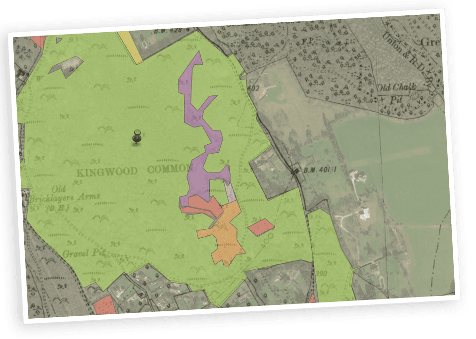
A pilot application is under development to help our Conservation team manage the infrastructure at Chiltern Society conservation sites. It will use an app installed on a mobile phone to record data at the sites and hold this information against locations on a map. Use of maps to assist the planning volunteers monitor planning policies and planning applications across the area is also in progress. Other potential areas in discussion include use with the Rivers and Wetlands Group and input into Heritage projects such as the Hillforts project and mapping Industrial Archaeology.
3. Implementation
Embed the system within the Chiltern Society organisation so that it can be managed effectively for the benefit of the Society, and used in support of its work and promotion of the Chilterns landscape.
1. Evaluation
Identify and trial a suitable GIS system for use within the Chiltern Society. We have completed this and selected ArcGIS developed by ESRI*. Based on cloud computing, it enables collaborative working between volunteers and has the tools to support data collection, map production and publication.
2. Pilot
A pilot application is under development to help our Conservation team manage the infrastructure at Chiltern Society conservation sites. It will use an app installed on a mobile phone to record data at the sites and hold this information against locations on a map. Use of maps to assist the planning volunteers monitor planning policies and planning applications across the area is also in progress. Other potential areas in discussion include use with the Rivers and Wetlands Group and input into Heritage projects such as the Hillforts project and mapping Industrial Archaeology.
3. Implementation
Embed the system within the Chiltern Society organisation so that it can be managed effectively for the benefit of the Society, and used in support of its work and promotion of the Chilterns landscape.
Get involved
If you have any experience of GIS systems and ArcGIS in particular, and can devote some time in helping us develop applications, please contact Greg Wright.
*Environmental Systems Research Institute (UK), Aylesbury.
Subscribe to our eNews
Join us
Get involved
If you have any experience of GIS systems and ArcGIS in particular, and can devote some time in helping us develop applications, please contact Greg Wright.
*Environmental Systems Research Institute (UK), Aylesbury.